MyTopo
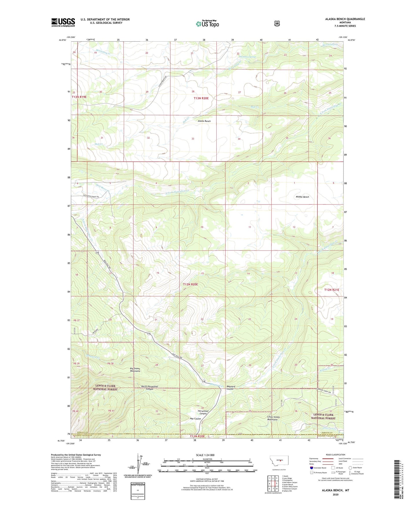
Alaska Bench Montana US Topo Map
Couldn't load pickup availability
Also explore the Alaska Bench Forest Service Topo of this same quad for updated USFS data
2024 topographic map quadrangle Alaska Bench in the state of Montana. Scale: 1:24000. Based on the newly updated USGS 7.5' US Topo map series, this map is in the following counties: Fergus, Golden Valley. The map contains contour data, water features, and other items you are used to seeing on USGS maps, but also has updated roads and other features. This is the next generation of topographic maps. Printed on high-quality waterproof paper with UV fade-resistant inks.
Quads adjacent to this one:
West: Half Moon Canyon
Northwest: Heath
North: Loco Ridge
Northeast: Forestgrove
East: South Bench
Southeast: Sahara Hill
South: Patterson Canyon
Southwest: Green Ashly Gulch
This map covers the same area as the classic USGS quad with code o46109g2.
Contains the following named places: Alaska Bench, Half Moon Creek, Half Moon Pass School, Hay Coulee, Holt Creek, Horsethief Canyon, Little Snowy Mountains, Maynard Coulee, Maynard Creek, McCartney Springs, Middle Bench, Morrison School, North Horsethief Canyon