MyTopo
Forestgrove Montana US Topo Map
Couldn't load pickup availability
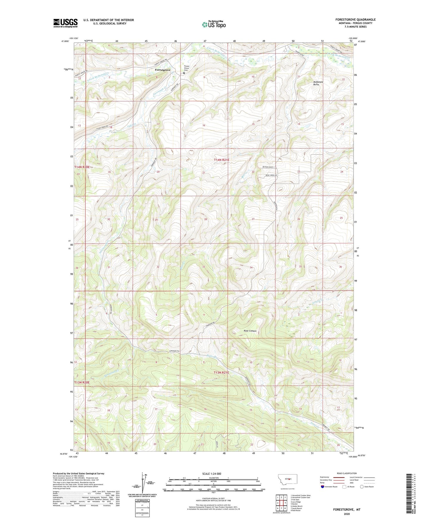
2024 topographic map quadrangle Forestgrove in the state of Montana. Scale: 1:24000. Based on the newly updated USGS 7.5' US Topo map series, this map is in the following counties: Fergus. The map contains contour data, water features, and other items you are used to seeing on USGS maps, but also has updated roads and other features. This is the next generation of topographic maps. Printed on high-quality waterproof paper with UV fade-resistant inks.
Quads adjacent to this one:
West: Loco Ridge
Northwest: Horsethief Coulee West
North: Horsethief Coulee East
Northeast: Fish Dam
East: Becket
Southeast: Bald Butte
South: South Bench
Southwest: Alaska Bench
This map covers the same area as the classic USGS quad with code o46109h1.
Contains the following named places: Bear Creek, Brodie, Fairview School, Forest Grove Cemetery, Forest Grove School, Forestgrove, Forestgrove Post Office, Greenwood School, McDonald Butte, McLean Elevator, Saint Pauls Episcopal Church, Surenough Creek, Surenuff School, Tyler Creek