MyTopo
Swede Mountain Montana US Topo Map
Couldn't load pickup availability
Also explore the Swede Mountain Forest Service Topo of this same quad for updated USFS data
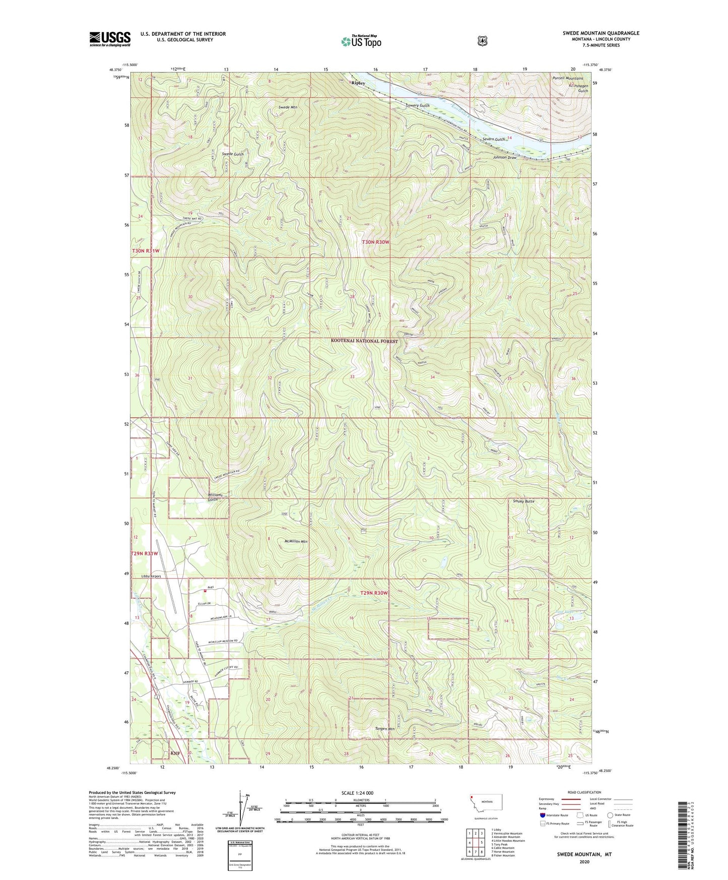
2024 topographic map quadrangle Swede Mountain in the state of Montana. Scale: 1:24000. Based on the newly updated USGS 7.5' US Topo map series, this map is in the following counties: Lincoln. The map contains contour data, water features, and other items you are used to seeing on USGS maps, but also has updated roads and other features. This is the next generation of topographic maps. Printed on high-quality waterproof paper with UV fade-resistant inks.
Quads adjacent to this one:
West: Little Hoodoo Mountain
Northwest: Libby
North: Vermiculite Mountain
Northeast: Alexander Mountain
East: Tony Peak
Southeast: Fisher Mountain
South: Horse Mountain
Southwest: Cable Mountain
This map covers the same area as the classic USGS quad with code o48115c4.
Contains the following named places: 29N30W06BBC_01 Well, 29N30W06BCB_01 Well, 29N30W06BCB_02 Well, 29N30W06CBB_01 Well, 29N30W18ABC_01 Well, 29N30W18DBDA01 Well, 29N30W19ABA_01 Well, 29N30W19ABB_01 Well, 29N30W19ABD_01 Well, 29N30W19ADA_01 Well, 29N30W19ADB_01 Well, 29N30W19BCB_01 Well, 29N30W19BCD_01 Well, 29N30W19BDA_01 Well, 29N30W19BDB_01 Well, 29N30W19CAB_01 Well, 29N30W19CBD_01 Well, 29N30W19CCA_01 Well, 29N30W19DBC_01 Well, 29N30W30BAA_01 Well, 29N31W13DAC_01 Well, 29N31W13DDB_01 Well, 29N31W13DDB_02 Well, 29N31W13DDC_01 Well, Big Swede Lookout, Cabinet View Fire Department, Johnson Draw, Libby Airport, Lost Lake, Lowery Gulch, McMillan Creek, McMillan Mountain, Ripley Post Office, Severn Gulch, Smoky Butte, Swede Mountain, Tangen Mountain, Williams Gulch