
MyTopo
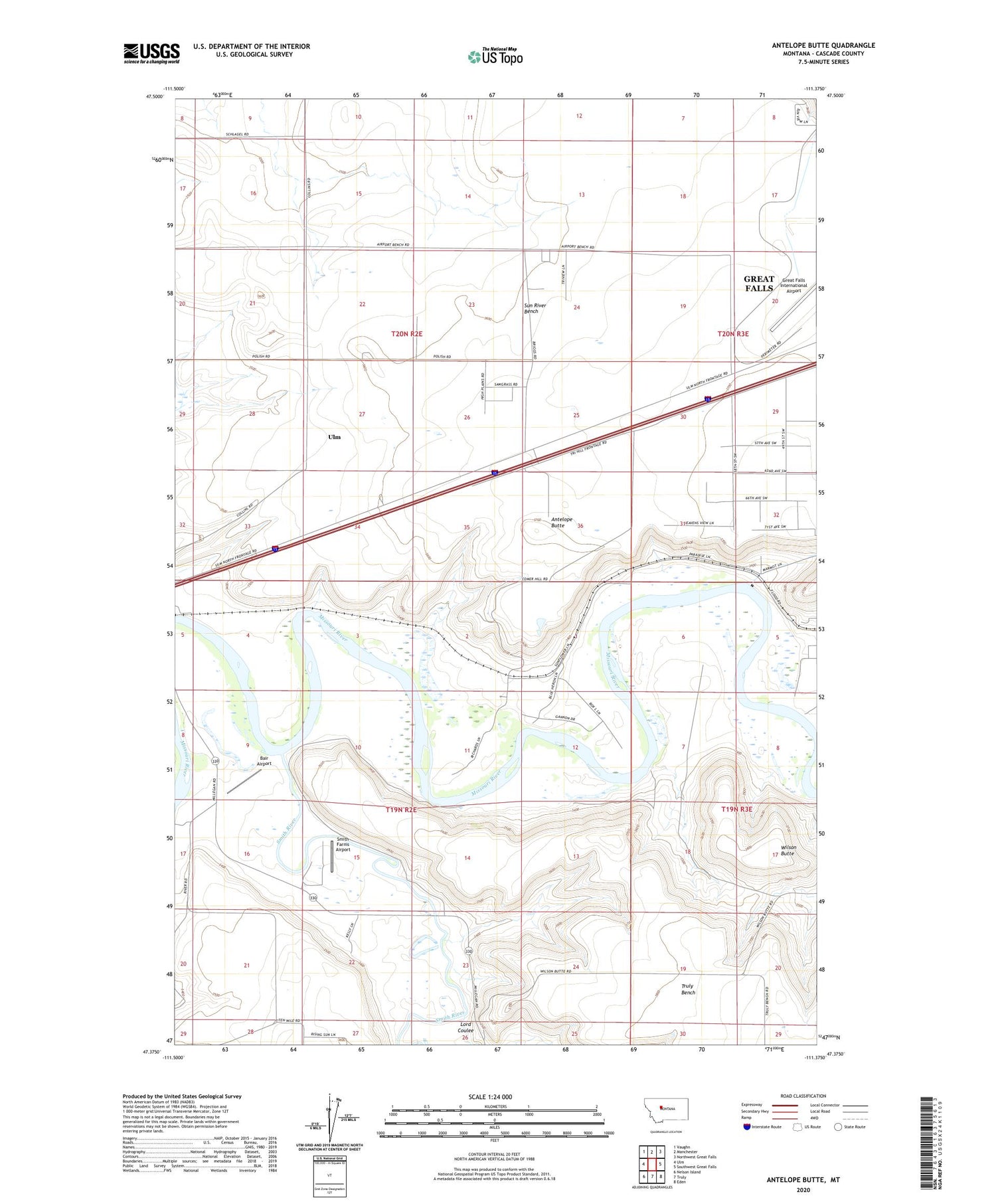
Antelope Butte Montana US Topo Map
Couldn't load pickup availability
2020 topographic map quadrangle Antelope Butte in the state of Montana. Scale: 1:24000. Based on the newly updated USGS 7.5' US Topo map series, this map is in the following counties: Cascade. The map contains contour data, water features, and other items you are used to seeing on USGS maps, but also has updated roads and other features. This is the next generation of topographic maps. Printed on high-quality waterproof paper with UV fade-resistant inks.
Quads adjacent to this one:
West: Ulm
Northwest: Vaughn
North: Manchester
Northeast: Northwest Great Falls
East: Southwest Great Falls
Southeast: Eden
South: Truly
Southwest: Nelson Island
Contains the following named places: 19N02E01BCBC01 Well, 19N02E08DDDD01 Well, 19N02E21D___01 Well, 19N02E23C___01 Well, 19N03E05BABA01 Well, 20N02E13____01 Well, 20N02E15____01 Well, 20N02E15A___01 Well, 20N02E15D___01 Well, 20N02E21____01 Well, 20N02E22____01 Well, 20N02E22C___01 Well, 20N02E22C___02 Well, 20N02E22C___03 Well, 20N02E22C___04 Well, 20N02E22D___01 Well, 20N02E23A___01 Well, 20N02E23C___01 Well, 20N02E24B___01 Well, 20N02E25C___01 Well, 20N02E28____01 Well, 20N02E28____02 Well, 20N02E28A___01 Well, 20N02E33B___01 Well, 20N02E33B___02 Well, 20N02E34A___01 Well, 20N02E35D___01 Well, 20N03E08DCBB01 Well, 20N03E17C___01 Well, 20N03E29ACBA01 Well, 20N03E29ADCC01 Well, 20N03E30A___01 Well, 20N03E32DBAB01 Well, 20N04E16CCBA02 Well, Antelope Butte, Bair Airport, Buchanan Ranch Airport, Ferguson School, Great Falls Division, Lord Coulee, Lower Smith River Fishing Access Site, Smith Farms Airport, Smith River, Sun River Bench, Sun River Bench School, Sun River Historical Marker, Ulm Bridge Fishing Access Site, Wilson Butte


