MyTopo
Vaughn Montana US Topo Map
Couldn't load pickup availability
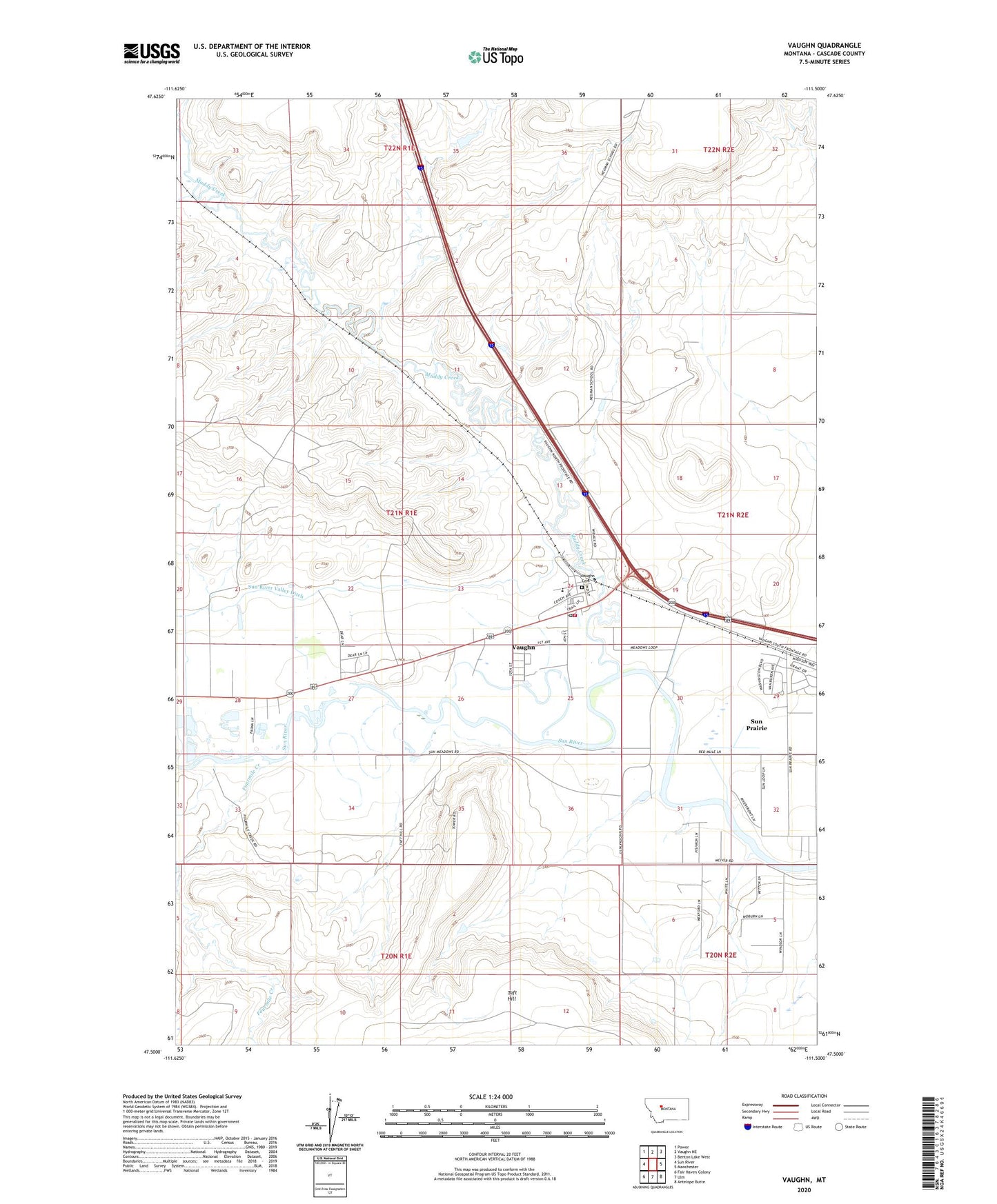
2024 topographic map quadrangle Vaughn in the state of Montana. Scale: 1:24000. Based on the newly updated USGS 7.5' US Topo map series, this map is in the following counties: Cascade. The map contains contour data, water features, and other items you are used to seeing on USGS maps, but also has updated roads and other features. This is the next generation of topographic maps. Printed on high-quality waterproof paper with UV fade-resistant inks.
Quads adjacent to this one:
West: Sun River
Northwest: Power
North: Vaughn NE
Northeast: Benton Lake West
East: Manchester
Southeast: Antelope Butte
South: Ulm
Southwest: Fair Haven Colony
This map covers the same area as the classic USGS quad with code o47111e5.
Contains the following named places: 20N01E02BBAC01 Well, 20N01E02BBBD01 Well, 20N01E12____01 Well, 20N02E05BBAC01 Well, 20N02E05CBDA01 Well, 20N02E05CCDC01 Well, 21N01E13DCDA01 Well, 21N01E25DBAC01 Well, 21N02E29CABC01 Well, Eidel Salo Dam, Fourmile Creek, Ida Post Office, Leavings, Muddy Creek, Neuman Dam, Priests Crossing, Sun River Junction, Taft School, Vaughn, Vaughn Cemetery, Vaughn Census Designated Place, Vaughn Community Bible Church, Vaughn Post Office, Vaughn School, Vaughn Volunteer Fire Department