MyTopo
Baker Monument Montana US Topo Map
Couldn't load pickup availability
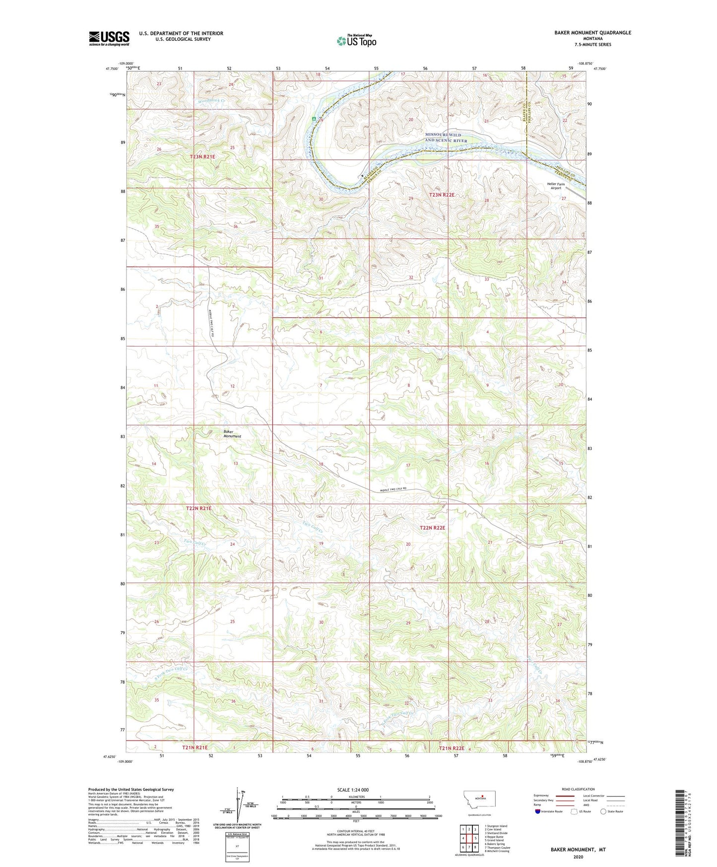
2020 topographic map quadrangle Baker Monument in the state of Montana. Scale: 1:24000. Based on the newly updated USGS 7.5' US Topo map series, this map is in the following counties: Fergus, Blaine, Phillips. The map contains contour data, water features, and other items you are used to seeing on USGS maps, but also has updated roads and other features. This is the next generation of topographic maps. Printed on high-quality waterproof paper with UV fade-resistant inks.
Quads adjacent to this one:
West: Reppe Butte
Northwest: Sturgeon Island
North: Cow Island
Northeast: Shetland Divide
East: Grand Island
Southeast: Mitchell Crossing
South: Thompson Coulee
Southwest: Bakers Spring
Contains the following named places: 22N22E34BB__01 Well, 22N22E34CB__01 Well, Baker Monument, Barnes Ridge, Gumbo Dam, Heller Farm Airport, Heller School, Phillips Power Plant, Power Plant, South Fork Two Calf Creek, Woodhawk Creek