MyTopo
Ranchester Wyoming US Topo Map
Couldn't load pickup availability
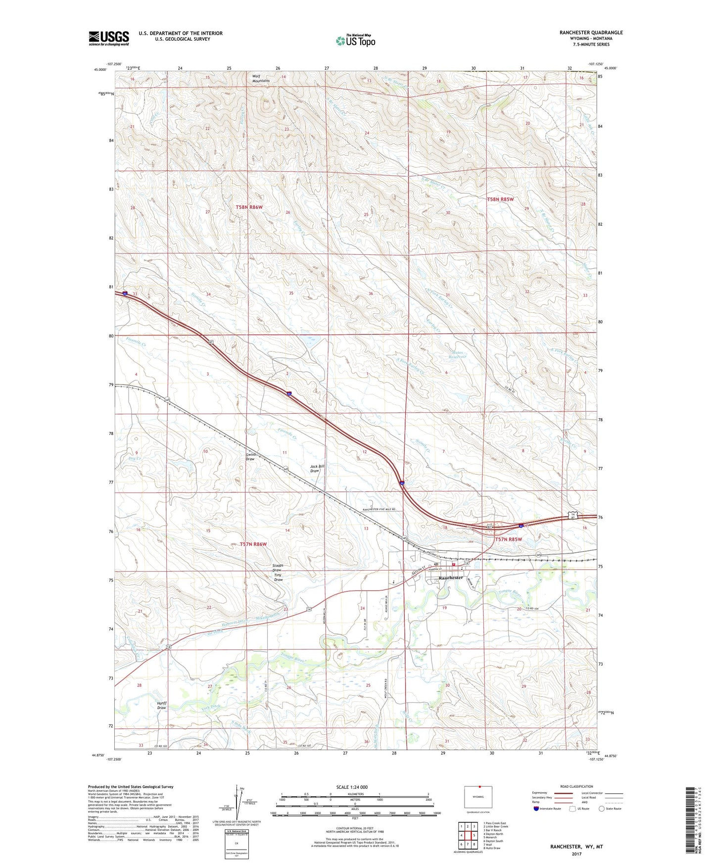
2021 topographic map quadrangle Ranchester in the state of Wyoming. Scale: 1:24000. Based on the newly updated USGS 7.5' US Topo map series, this map is in the following counties: Sheridan, Big Horn. The map contains contour data, water features, and other items you are used to seeing on USGS maps, but also has updated roads and other features. This is the next generation of topographic maps. Printed on high-quality waterproof paper with UV fade-resistant inks.
Quads adjacent to this one:
West: Dayton North
Northwest: Pass Creek East
North: Little Bear Creek
Northeast: Bar V Ranch
East: Monarch
Southeast: Hultz Draw
South: Wolf
Southwest: Dayton South
This map covers the same area as the classic USGS quad with code o44107h2.
Contains the following named places: Barker Dam, Barker Reservoir, Belish Dam, Belish Reservoir, Case Golden Age Care Hospital, Columbus Creek, Dry Creek, Dzendolet Dam, Dzendolet Reservoir, Fivemile Creek, Gwinn Draw, Hanff Draw, Hanover Ditch, Jack Bill Draw, Mates Dam, Mates Reservoir, Mikado Ditch, North Branch Slater Creek, North Fork Earley Creek, Oz Ditch, Pleasantview Senior Care Hospital, Ranchester, Ranchester Post Office, Ranchester Volunteer Fire Department, South Branch Slater Creek, South Fork Earley Creek, Stoops Draw, Tiny Draw, Tongue River Elementary School, Tongue River Middle School, Town of Ranchester, Turner and Swan Dam, Turner and Swan Reservoir, Wesley Dam, Wesley Reservoir, Wolf Creek, York Ditch, ZIP Code: 82839