MyTopo
Monarch Wyoming US Topo Map
Couldn't load pickup availability
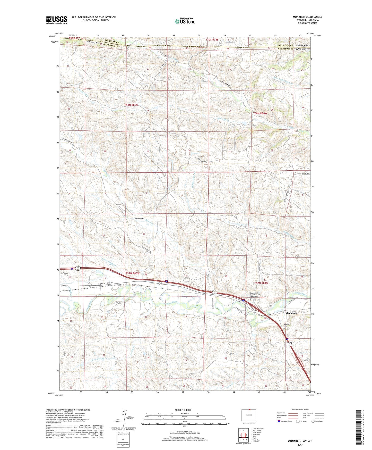
2021 topographic map quadrangle Monarch in the state of Wyoming. Scale: 1:24000. Based on the newly updated USGS 7.5' US Topo map series, this map is in the following counties: Sheridan, Big Horn. The map contains contour data, water features, and other items you are used to seeing on USGS maps, but also has updated roads and other features. This is the next generation of topographic maps. Printed on high-quality waterproof paper with UV fade-resistant inks.
Quads adjacent to this one:
West: Ranchester
Northwest: Little Bear Creek
North: Bar V Ranch
Northeast: Pearl School
East: Acme
Southeast: Sheridan
South: Hultz Draw
Southwest: Wolf
This map covers the same area as the classic USGS quad with code o44107h1.
Contains the following named places: Acme Number One Mine, Acme Number Three Mine, Armstrong Mine, Baldwin Dam, Baldwin Reservoir, Big Horn Mine, Black Mountain Mine, Buffalo Strip Mine, Carney Mine Number Forty-Four, Conable Prospect Mine, Dan Draw, Dietz Number One Mine, Earley Creek, East Fork Earley Creek, Evangelical Lutheran Cemetery of Monarch, Guernsey Stone Quarry, Kleenburn, Kleenburn Coal Tipple Mine, Kool Number Forty-six Mine, Little Ash Creek, Masters Mine, Meredith Dam, Meredith Reservoir, Model Mine, Monarch, Monarch Cemetery, Monarch Number Five Mine, New Monarch Mine, North Dry Creek, North Fork North Dry Creek, Old Monarch Mine, Riverside Mine, Sixmile Creek, Slater Creek, South Dry Creek, Tongue River Ditch, Welch Mine, Welch Strip Mine