MyTopo
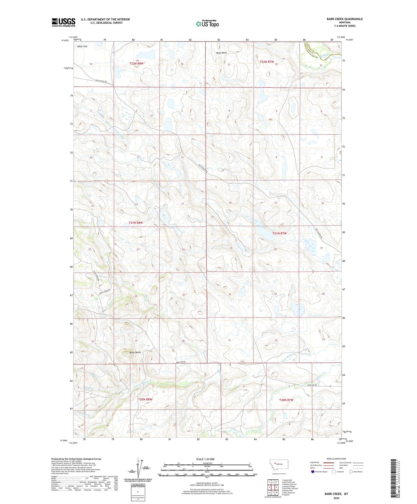
Barr Creek Montana US Topo Map
Couldn't load pickup availability
Also explore the Barr Creek Forest Service Topo of this same quad for updated USFS data
2024 topographic map quadrangle Barr Creek in the state of Montana. Scale: 1:24000. Based on the newly updated USGS 7.5' US Topo map series, this map is in the following counties: Lewis and Clark, Teton. The map contains contour data, water features, and other items you are used to seeing on USGS maps, but also has updated roads and other features. This is the next generation of topographic maps. Printed on high-quality waterproof paper with UV fade-resistant inks.
Quads adjacent to this one:
West: Sawtooth Ridge
Northwest: Castle Reef
North: Split Rock Lake
Northeast: Pishkun Reservoir
East: Split Rock Junction
Southeast: Augusta
South: Nilan Reservoir
Southwest: Double Falls
This map covers the same area as the classic USGS quad with code o47112e5.
Contains the following named places: Barr Creek, Black Butte, Cutrock Creek, Eddie Creek, Geldrich Ditch, Morris Ranch, Porrini Dam, Rose Creek, Sassafras Dam, Shed Creek, Sun River Game Range Headquarters