MyTopo
Split Rock Junction Montana US Topo Map
Couldn't load pickup availability
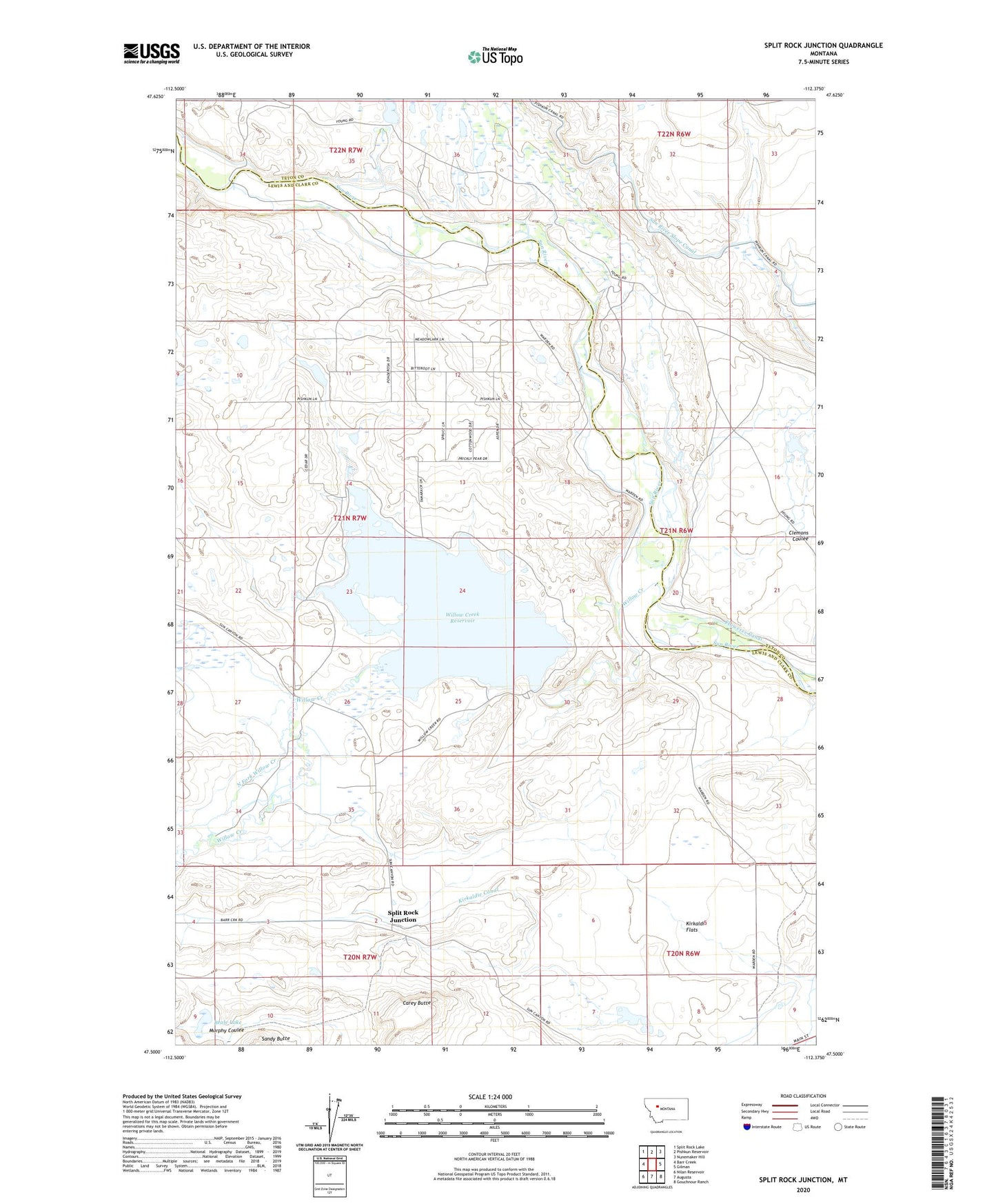
2024 topographic map quadrangle Split Rock Junction in the state of Montana. Scale: 1:24000. Based on the newly updated USGS 7.5' US Topo map series, this map is in the following counties: Lewis and Clark, Teton. The map contains contour data, water features, and other items you are used to seeing on USGS maps, but also has updated roads and other features. This is the next generation of topographic maps. Printed on high-quality waterproof paper with UV fade-resistant inks.
Quads adjacent to this one:
West: Barr Creek
Northwest: Split Rock Lake
North: Pishkun Reservoir
Northeast: Nunemaker Hill
East: Gilman
Southeast: Gouchnour Ranch
South: Augusta
Southwest: Nilan Reservoir
This map covers the same area as the classic USGS quad with code o47112e4.
Contains the following named places: Beale Lake, Carey Butte, Gordan Lightfoot Dam, Kirkaldie Canal, Kirkaldie Flats, North Fork Willow Creek, Peach Fuzz Dam, Split Rock Junction, Willow Creek, Willow Creek Dam, Willow Creek Dike 5, Willow Creek National Wildlife Refuge, Willow Creek Reservoir, Willow Creek Reservoir Fishing Access Site, Young Clemons Dam, Young Sun Dam