MyTopo
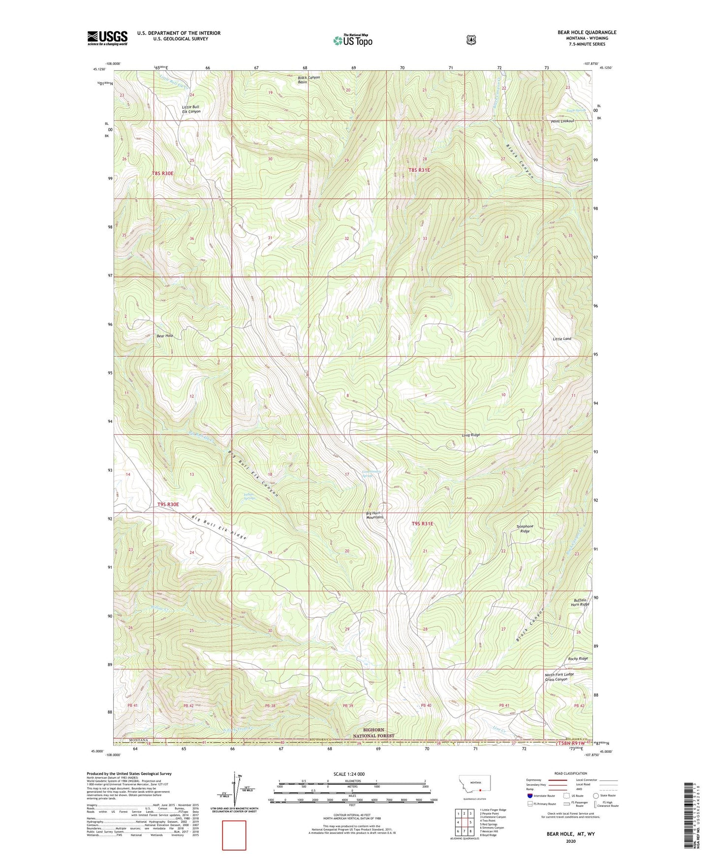
Bear Hole Montana US Topo Map
Couldn't load pickup availability
Also explore the Bear Hole Forest Service Topo of this same quad for updated USFS data
2024 topographic map quadrangle Bear Hole in the state of Montana. Scale: 1:24000. Based on the newly updated USGS 7.5' US Topo map series, this map is in the following counties: Big Horn, Sheridan. The map contains contour data, water features, and other items you are used to seeing on USGS maps, but also has updated roads and other features. This is the next generation of topographic maps. Printed on high-quality waterproof paper with UV fade-resistant inks.
Quads adjacent to this one:
West: Two Point
Northwest: Little Finger Ridge
North: Peyote Point
Northeast: Limestone Canyon
East: Red Springs
Southeast: Boyd Ridge
South: Mexican Hill
Southwest: Simmons Canyon
Contains the following named places: Bear Hole, Big Bull Elk Ridge, Black Cabin, Black Canyon Basin, Commissary Spring, Eagle Spring, Indian Springs, Little Land, Long Ridge, Point Lookout, Rocky Ridge, Telephone Ridge, Windy Point Lookout