MyTopo
Two Point Montana US Topo Map
Couldn't load pickup availability
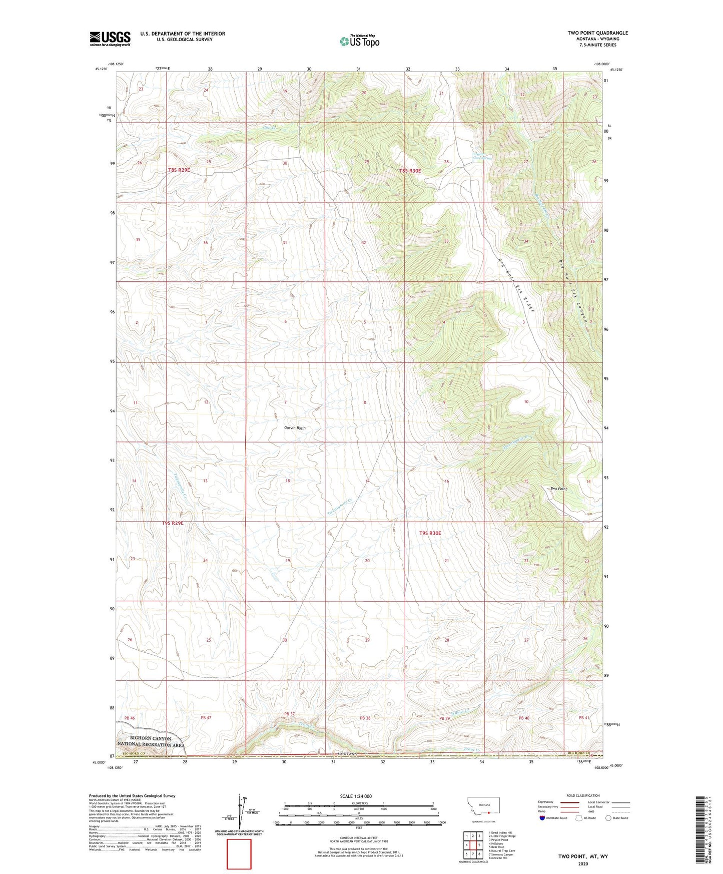
2024 topographic map quadrangle Two Point in the state of Montana. Scale: 1:24000. Based on the newly updated USGS 7.5' US Topo map series, this map is in the following counties: Big Horn. The map contains contour data, water features, and other items you are used to seeing on USGS maps, but also has updated roads and other features. This is the next generation of topographic maps. Printed on high-quality waterproof paper with UV fade-resistant inks.
Quads adjacent to this one:
West: Hillsboro
Northwest: Dead Indian Hill
North: Little Finger Ridge
Northeast: Peyote Point
East: Bear Hole
Southeast: Mexican Hill
South: Simmons Canyon
Southwest: Natural Trap Cave
Contains the following named places: Crystal Cave Spring, Two Point, Willow Creek