MyTopo
Peyote Point Montana US Topo Map
Couldn't load pickup availability
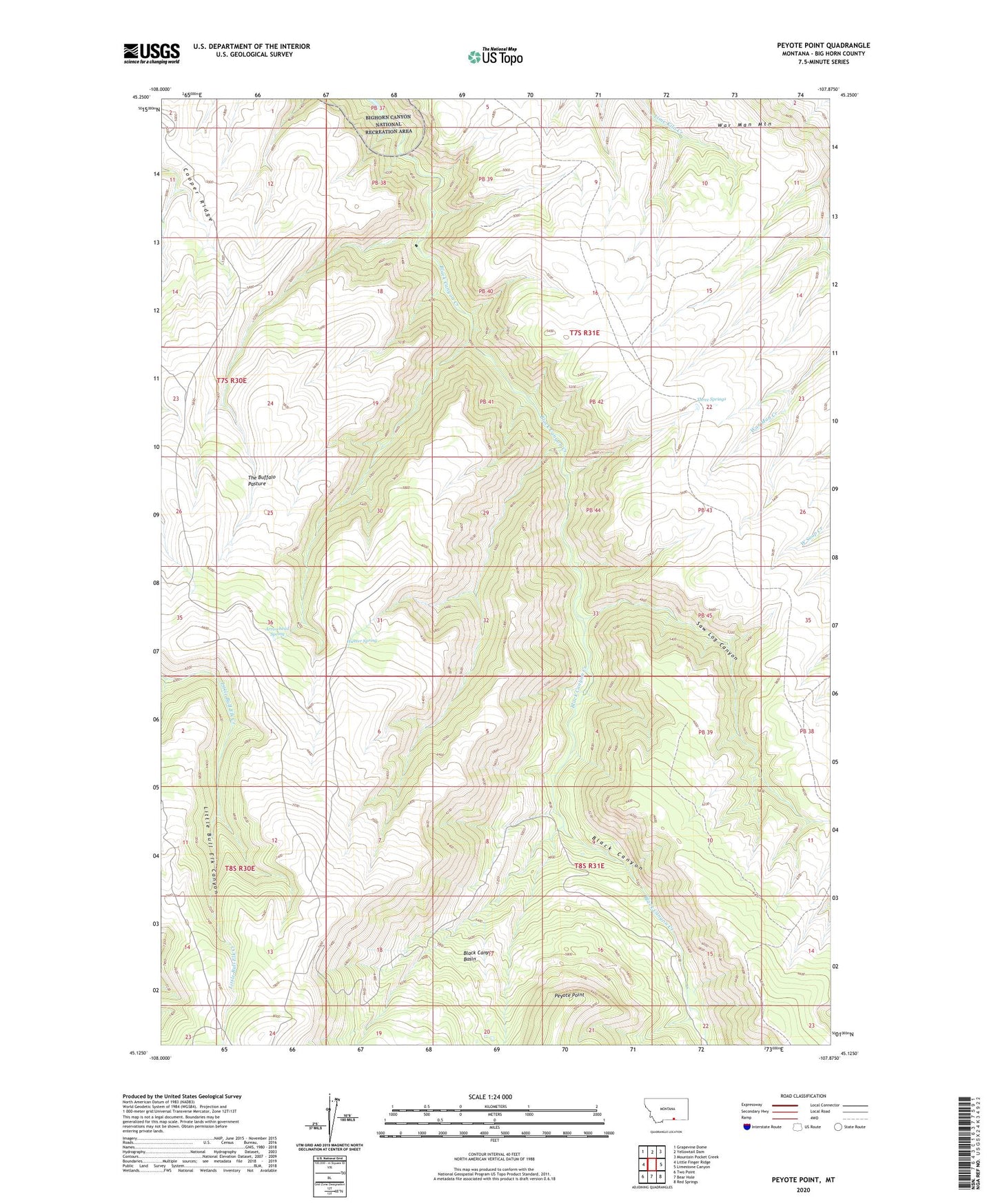
2024 topographic map quadrangle Peyote Point in the state of Montana. Scale: 1:24000. Based on the newly updated USGS 7.5' US Topo map series, this map is in the following counties: Big Horn. The map contains contour data, water features, and other items you are used to seeing on USGS maps, but also has updated roads and other features. This is the next generation of topographic maps. Printed on high-quality waterproof paper with UV fade-resistant inks.
Quads adjacent to this one:
West: Little Finger Ridge
Northwest: Grapevine Dome
North: Yellowtail Dam
Northeast: Mountain Pocket Creek
East: Limestone Canyon
Southeast: Red Springs
South: Bear Hole
Southwest: Two Point
This map covers the same area as the classic USGS quad with code o45107b8.
Contains the following named places: Absaloka Youth Camp, Arrowhead Spring, Black Canyon Creek, Cooper Ridge, Hunter Cabin, Hunter Spring, Peyote Point, Saw Log Canyon, Soldier Trail, The Buffalo Pasture, Three Springs, Three Springs Trail