MyTopo
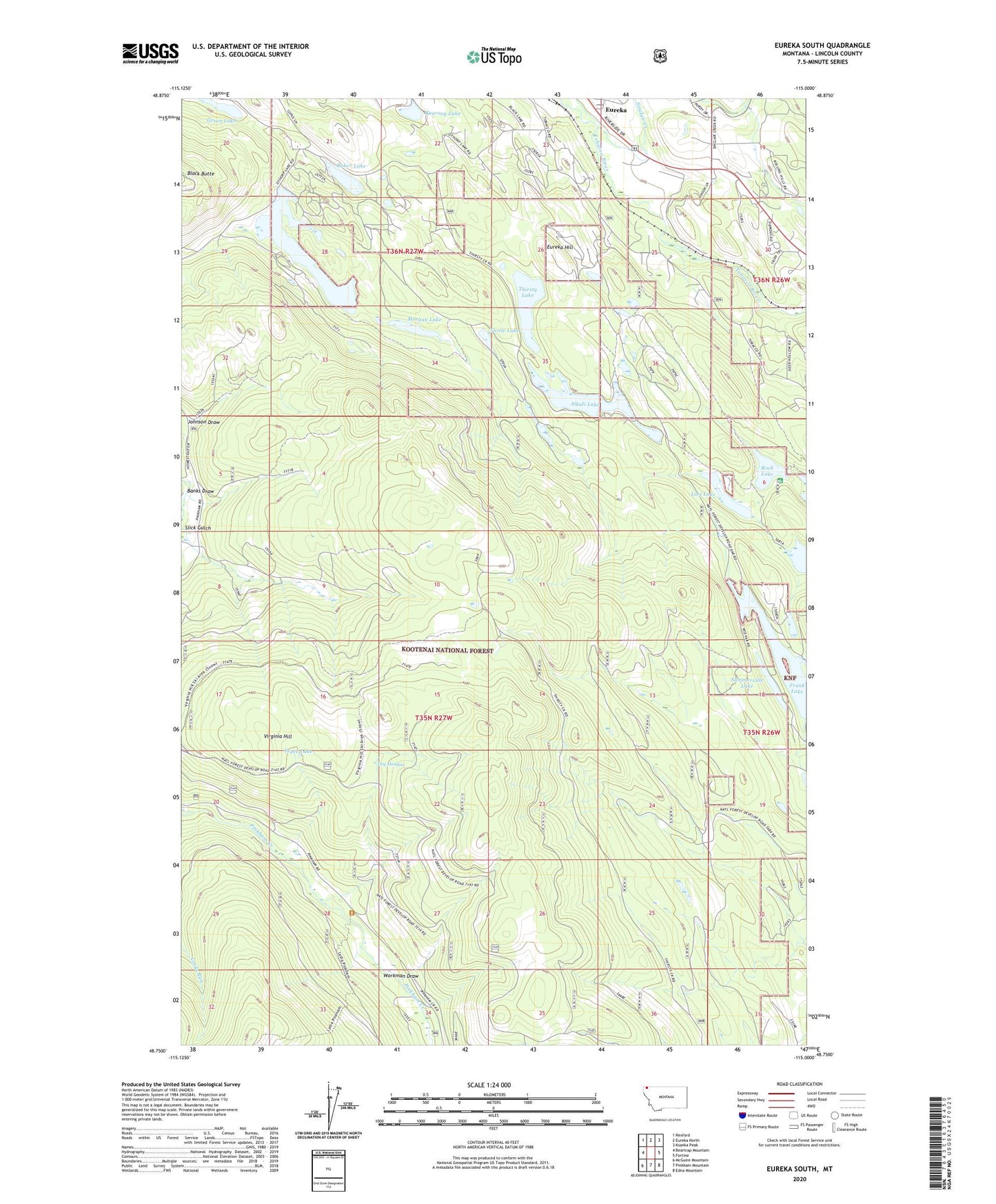
Eureka South Montana US Topo Map
Couldn't load pickup availability
Also explore the Eureka South Forest Service Topo of this same quad for updated USFS data
2024 topographic map quadrangle Eureka South in the state of Montana. Scale: 1:24000. Based on the newly updated USGS 7.5' US Topo map series, this map is in the following counties: Lincoln. The map contains contour data, water features, and other items you are used to seeing on USGS maps, but also has updated roads and other features. This is the next generation of topographic maps. Printed on high-quality waterproof paper with UV fade-resistant inks.
Quads adjacent to this one:
West: Beartrap Mountain
Northwest: Rexford
North: Eureka North
Northeast: Ksanka Peak
East: Fortine
Southeast: Edna Mountain
South: Pinkham Mountain
Southwest: McGuire Mountain
This map covers the same area as the classic USGS quad with code o48115g1.
Contains the following named places: 35N27W05CACD01 Well, 35N27W05CBA_01 Well, 36N27W23DDDD01 Well, Alkali Lake, Baker Lake, Banks Draw, Dry Meadow, Eureka Division, Eureka Hill, Frank Lake, Frank Lake Fishing Access Site, Green Lake, Johnson Draw, Kearney Lake, Lost Lake, Luman H Bradburn Mine, Morgan Lake, Othorp Lake, Rock Lake, Rock Lake Campground, Slick Gulch, Summerville Lake, Tepee Lake, Thirsty Lake, Timber Lake, Tobacco Plains Historical Marker, Turtle Lake, Virginia Hill, Workman Draw