MyTopo
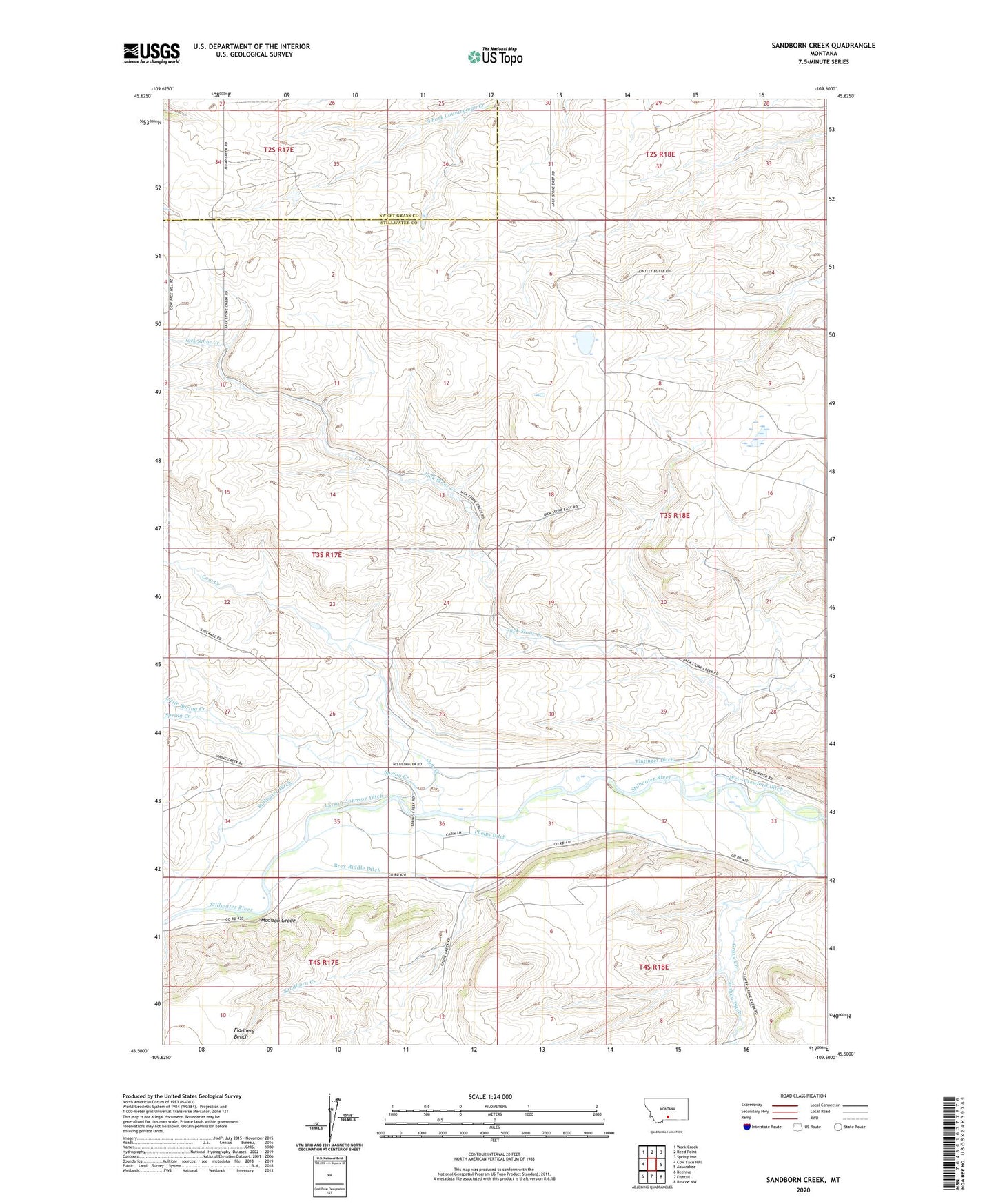
Sandborn Creek Montana US Topo Map
Couldn't load pickup availability
2024 topographic map quadrangle Sandborn Creek in the state of Montana. Scale: 1:24000. Based on the newly updated USGS 7.5' US Topo map series, this map is in the following counties: Stillwater, Sweet Grass. The map contains contour data, water features, and other items you are used to seeing on USGS maps, but also has updated roads and other features. This is the next generation of topographic maps. Printed on high-quality waterproof paper with UV fade-resistant inks.
Quads adjacent to this one:
West: Cow Face Hill
Northwest: Work Creek
North: Reed Point
Northeast: Springtime
East: Absarokee
Southeast: Roscoe NW
South: Fishtail
Southwest: Beehive
This map covers the same area as the classic USGS quad with code o45109e5.
Contains the following named places: 03S18E33BDAB01 Well, 59001, Arthun Ditch, Barrons Corner, Brey Riddle Ditch, Cow Creek, Jack Stone Creek, Kent Lake School, Kiehl Post Office, Larson-Johnson Ditch, Little Spring Creek, Madison Grade, Phelps Ditch, Rosann Rosanna Dana Dam, Sandborn Creek, Spring Creek, Spring Creek School, Stillwater Ditch, Tintinger Ditch, Weir-Crawford Ditch