MyTopo
Cow Face Hill Montana US Topo Map
Couldn't load pickup availability
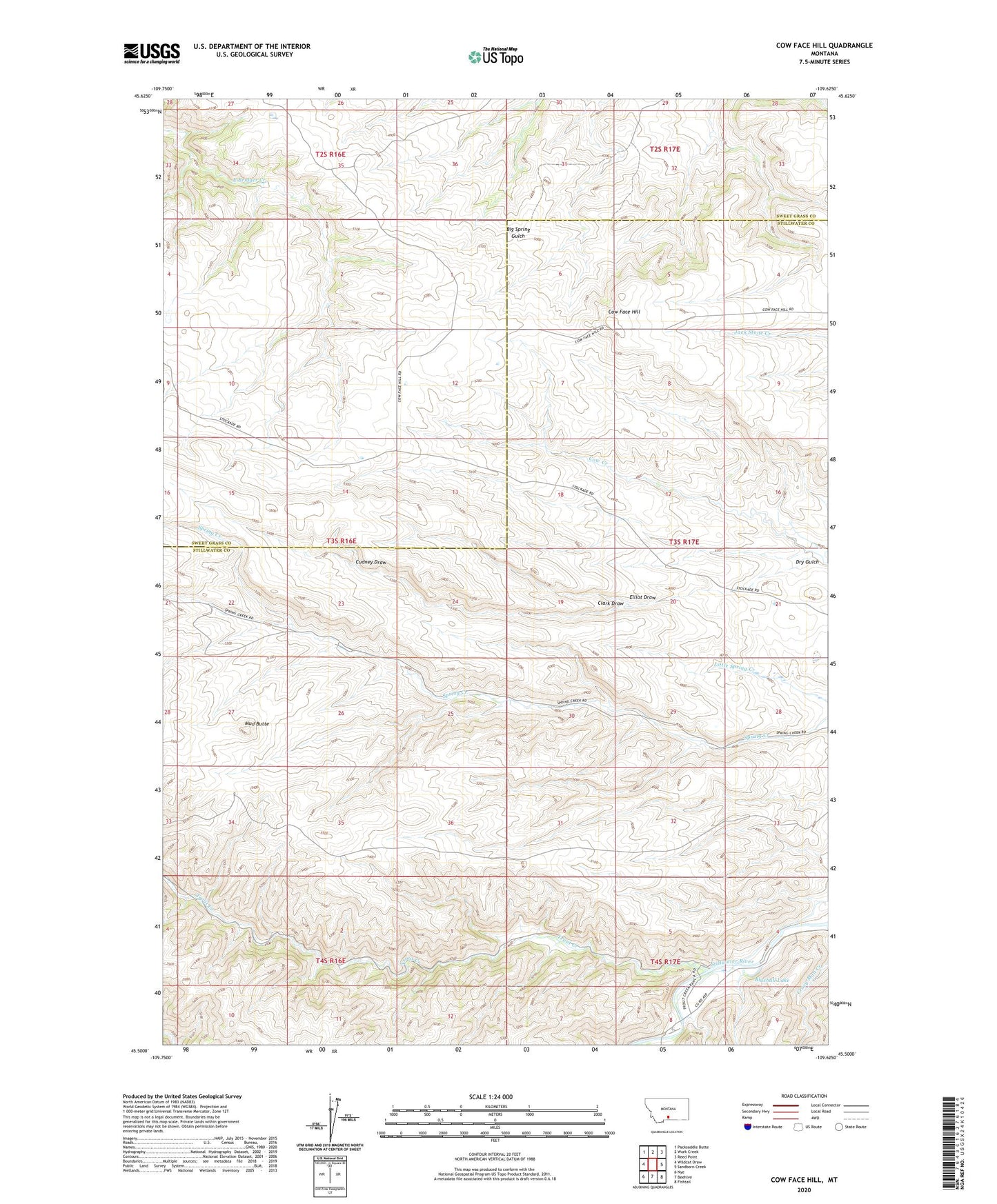
2024 topographic map quadrangle Cow Face Hill in the state of Montana. Scale: 1:24000. Based on the newly updated USGS 7.5' US Topo map series, this map is in the following counties: Stillwater, Sweet Grass. The map contains contour data, water features, and other items you are used to seeing on USGS maps, but also has updated roads and other features. This is the next generation of topographic maps. Printed on high-quality waterproof paper with UV fade-resistant inks.
Quads adjacent to this one:
West: Wildcat Draw
Northwest: Packsaddle Butte
North: Work Creek
Northeast: Reed Point
East: Sandborn Creek
Southeast: Fishtail
South: Beehive
Southwest: Nye
This map covers the same area as the classic USGS quad with code o45109e6.
Contains the following named places: 04S17E08BDDA01 Well, Blueball Lake, Clark Draw, Cliff Swallow Fishing Access Site, Cow Face Hill, Crazy Man Creek, Cudney Draw, Dry Gulch, Elliot Draw, Mud Butte, Springcreek Post Office, Stockade Post Office, Stockade School, Stone Breastwork Indian Battlesite, Trout Creek, Upper Spring Creek School