MyTopo
Benteen Montana US Topo Map
Couldn't load pickup availability
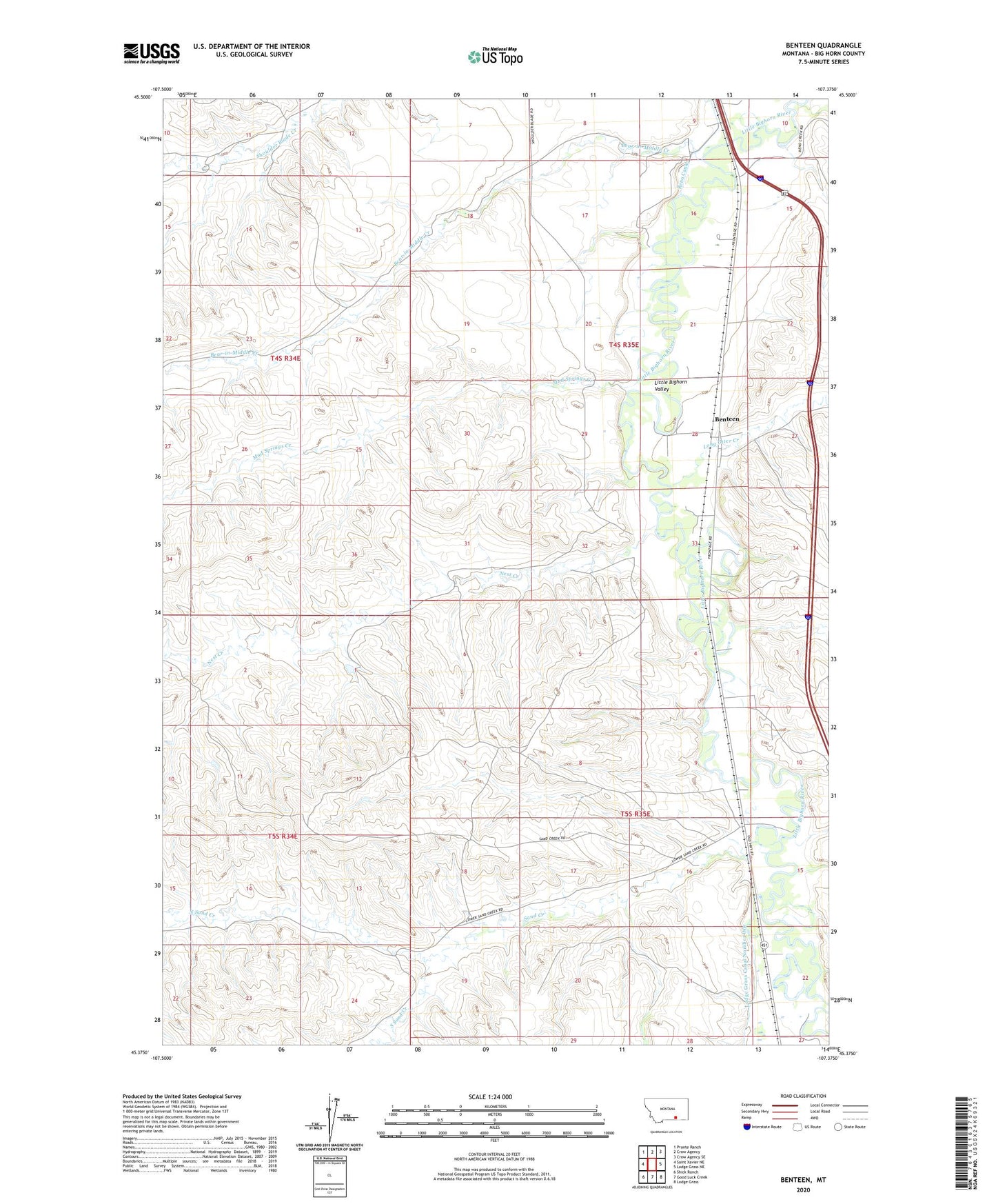
2024 topographic map quadrangle Benteen in the state of Montana. Scale: 1:24000. Based on the newly updated USGS 7.5' US Topo map series, this map is in the following counties: Big Horn. The map contains contour data, water features, and other items you are used to seeing on USGS maps, but also has updated roads and other features. This is the next generation of topographic maps. Printed on high-quality waterproof paper with UV fade-resistant inks.
Quads adjacent to this one:
West: Saint Xavier NE
Northwest: Prante Ranch
North: Crow Agency
Northeast: Crow Agency SE
East: Lodge Grass NE
Southeast: Lodge Grass
South: Good Luck Creek
Southwest: Shick Ranch
This map covers the same area as the classic USGS quad with code o45107d4.
Contains the following named places: 04S34E11DA__01 Well, 04S35E09AC__01 Well, 04S35E09AD__01 Well, 04S35E09DABA01 Well, 04S35E09DB__01 Well, 04S35E09DC__01 Well, 04S35E09DDD_01 Well, 04S35E10CC__01 Well, 04S35E15ABBB01 Well, 04S35E16AD__01 Well, 04S35E16BD__01 Well, 04S35E16DC__01 Well, 04S35E16DC__02 Well, 04S35E16DCCC01 Well, 04S35E16DD__01 Well, 04S35E16DDDD01 Well, 04S35E21AA__01 Well, 04S35E21AACD01 Well, 04S35E21AD__01 Well, 04S35E21CD__01 Well, 04S35E21CD__02 Well, 04S35E21DC__01 Well, 04S35E28BD__01 Well, 04S35E28CBDB01 Well, 04S35E28DB__01 Well, 04S35E33AC__01 Well, 04S35E33DB__01 Well, 04S35E34DAAD01 Well, 05S35E03CC__01 Well, 05S35E03CCBC01 Well, 05S35E04AB__01 Well, 05S35E04DB__01 Well, 05S35E09AD__01 Well, 05S35E09DBDD01 Well, 05S35E09DD__01 Well, 05S35E09DDAA01 Well, 05S35E15CB__01 Well, 05S35E16AA__01 Well, 05S35E16AADC01 Well, 05S35E16DDDC01 Well, 05S35E22BB__01 Well, 05S35E22BDBB01 Well, 05S35E22CB__01 Well, 05S35E22CC__01 Well, 05S35E22DCBB01 Well, Bear-in-Middle Creek, Benteen, Big Horn County, Long Otter Creek, Mud Springs Creek, Nest Creek, North Sand Creek, Reno Ford, Sand Creek, Shavings Creek, South Sand Creek