MyTopo
Lodge Grass Montana US Topo Map
Couldn't load pickup availability
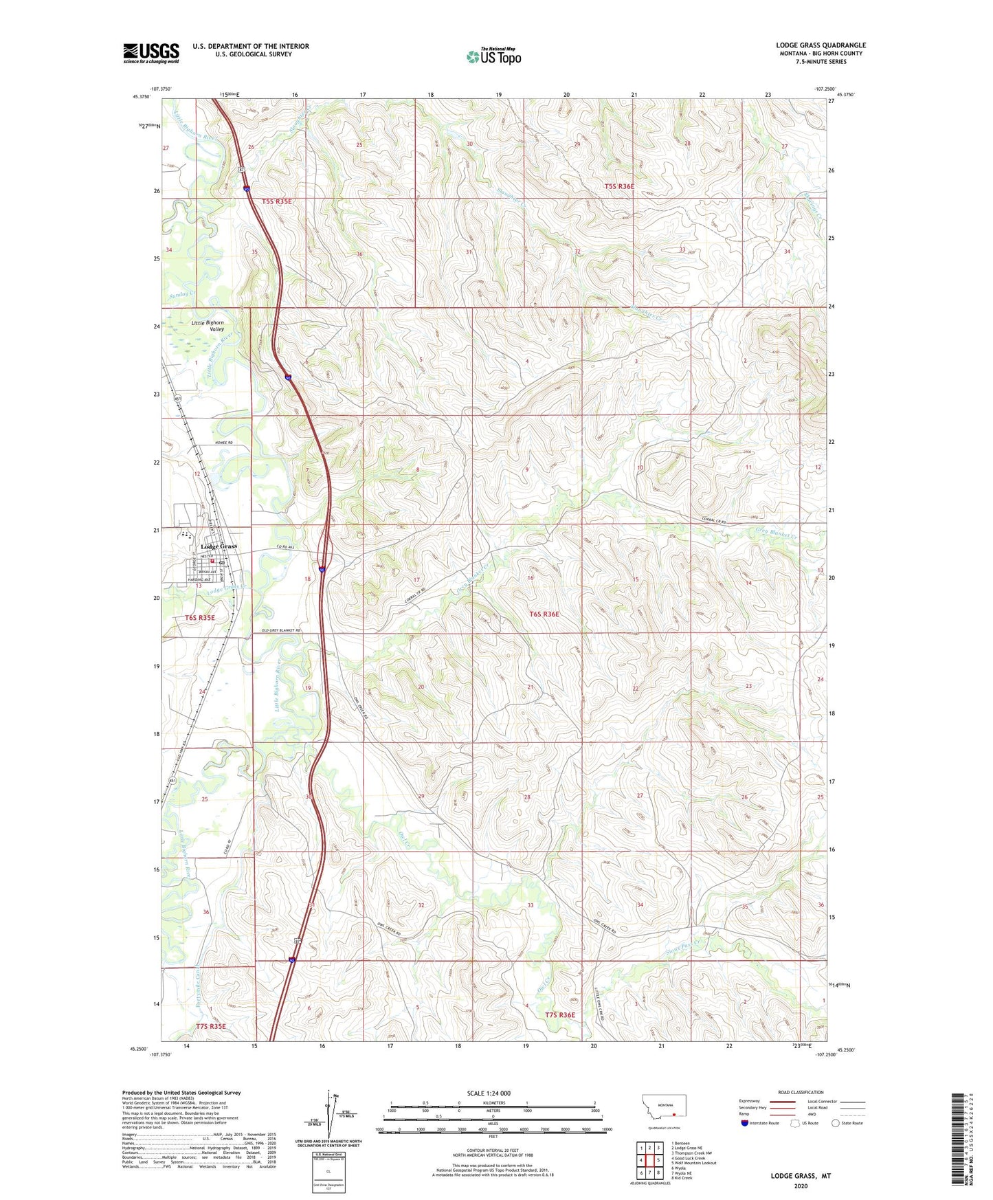
2024 topographic map quadrangle Lodge Grass in the state of Montana. Scale: 1:24000. Based on the newly updated USGS 7.5' US Topo map series, this map is in the following counties: Big Horn. The map contains contour data, water features, and other items you are used to seeing on USGS maps, but also has updated roads and other features. This is the next generation of topographic maps. Printed on high-quality waterproof paper with UV fade-resistant inks.
Quads adjacent to this one:
West: Good Luck Creek
Northwest: Benteen
North: Lodge Grass NE
Northeast: Thompson Creek NW
East: Wolf Mountain Lookout
Southeast: Kid Creek
South: Wyola NE
Southwest: Wyola
This map covers the same area as the classic USGS quad with code o45107c3.
Contains the following named places: 0635E25BAAA01_ Well, 06S35E01BCAA01 Well, 06S35E01CABA01 Well, 06S35E01CD__01 Well, 06S35E01DC__01 Well, 06S35E12ACBB01 Well, 06S35E12BDDC01 Well, 06S35E12DD__01 Well, 06S35E13AA__01 Well, 06S35E13AB__01 Well, 06S35E13AC__01 Well, 06S35E13AC__02 Well, 06S35E13AC__03 Well, 06S35E13AC__04 Well, 06S35E13AC__05 Well, 06S35E13ACAC01 Well, 06S35E13ADCC01 Well, 06S35E13BA__01 Well, 06S35E13BABD01 Well, 06S35E13CAAA01 Well, 06S35E13CAAA02 Well, 06S35E13CDAD01 Well, 06S35E13CDCB01 Well, 06S35E13DCBB01 Well, 06S35E24CACD01 Well, 06S35E24CACD02 Well, 06S35E25CDBB01 Well, 06S35E36BCBC01 Well, 06S36E06CBBA01 Well, 06S36E18ACAD01 Well, 06S36E29CDAC01 Well, 06S36E29DCDB01 Well, 06S36E33BACB01 Well, First Crow Indian Baptist Church, Fort C F Smith Historical Marker, Forty Mile Colony, Forty Mile Colony Census Designated Place, Fortymile Canal, Grey Blanket Creek, Grey Blanket School, Lodge Grass, Lodge Grass Creek, Lodge Grass Post Office, Lodge Grass School, Lodge Grass Volunteer Fire Department, Our Lady of Loretto Church, Owl Creek, Sioux Pass Creek, Slaughter Creek, Sunday Creek, Town of Lodge Grass, White Arm Park