MyTopo
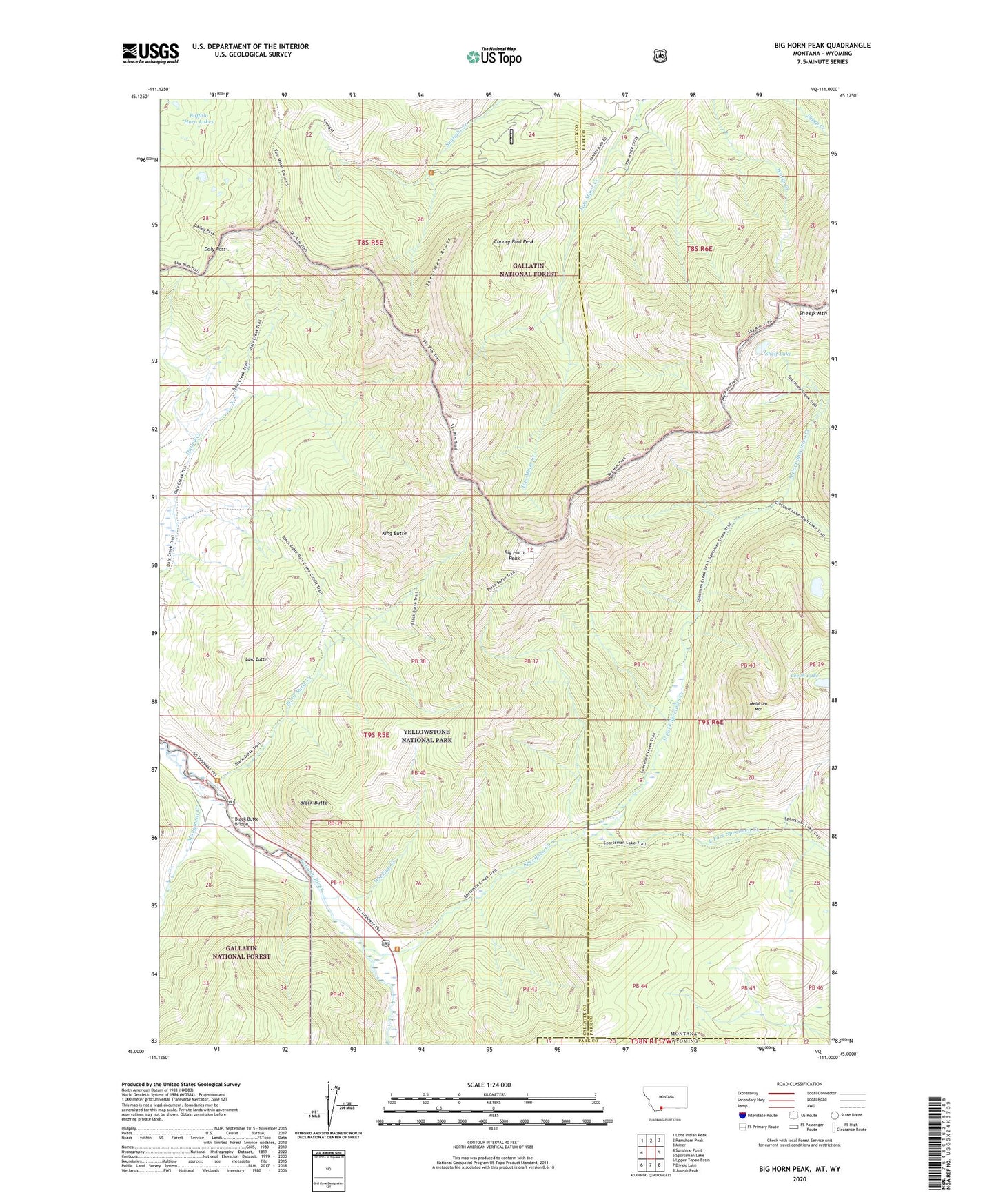
Big Horn Peak Montana US Topo Map
Couldn't load pickup availability
Also explore the Big Horn Peak Forest Service Topo of this same quad for updated USFS data
2024 topographic map quadrangle Big Horn Peak in the state of Montana. Scale: 1:24000. Based on the newly updated USGS 7.5' US Topo map series, this map is in the following counties: Gallatin, Park. The map contains contour data, water features, and other items you are used to seeing on USGS maps, but also has updated roads and other features. This is the next generation of topographic maps. Printed on high-quality waterproof paper with UV fade-resistant inks.
Quads adjacent to this one:
West: Sunshine Point
Northwest: Lone Indian Peak
North: Ramshorn Peak
Northeast: Miner
East: Sportsman Lake
Southeast: Joseph Peak
South: Divide Lake
Southwest: Upper Tepee Basin
Contains the following named places: Apex/Black Butte Mine, Big Horn Peak, Black Butte, Black Butte Bridge, Black Butte Creek, Black Butte Ranch, Buffalo Horn Lakes, Canary Bird Peak, Daly Pass, East Fork Specimen Creek, Gallatin Petrified Forest, Gallatin Ranger Station, King Butte, Lava Butte, Leech Lake, Meldrum Mountain, Monument Creek, North Fork Specimen Creek, Sheep Mountain, Shelf Lake, Specimen Creek, Specimen Creek Campground, Specimen Ridge, Wickiup Creek