MyTopo
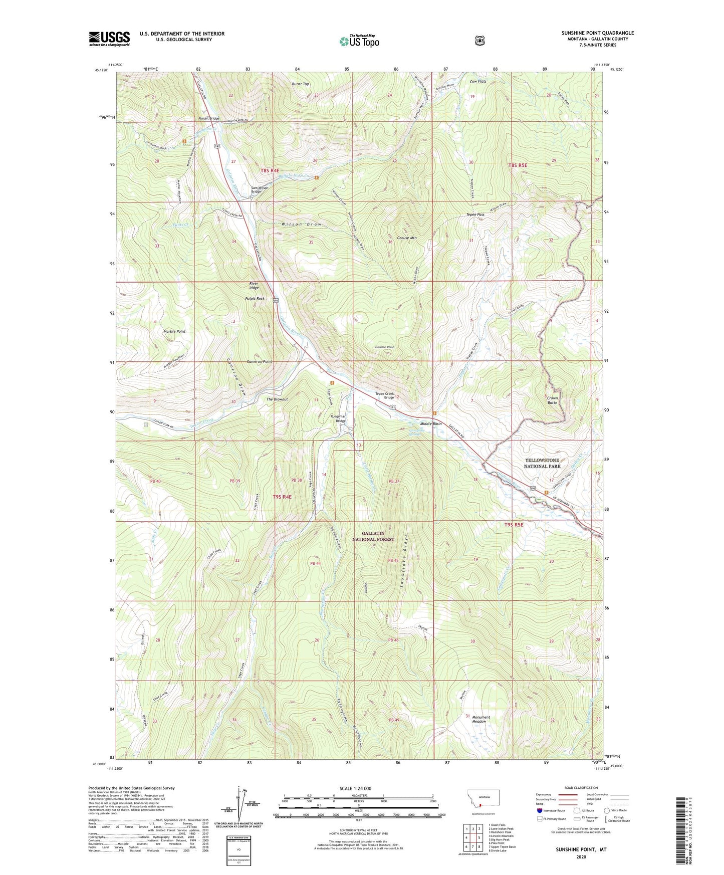
Sunshine Point Montana US Topo Map
Couldn't load pickup availability
Also explore the Sunshine Point Forest Service Topo of this same quad for updated USFS data
2024 topographic map quadrangle Sunshine Point in the state of Montana. Scale: 1:24000. Based on the newly updated USGS 7.5' US Topo map series, this map is in the following counties: Gallatin. The map contains contour data, water features, and other items you are used to seeing on USGS maps, but also has updated roads and other features. This is the next generation of topographic maps. Printed on high-quality waterproof paper with UV fade-resistant inks.
Quads adjacent to this one:
West: Lincoln Mountain
Northwest: Ousel Falls
North: Lone Indian Peak
Northeast: Ramshorn Peak
East: Big Horn Peak
Southeast: Divide Lake
South: Upper Tepee Basin
Southwest: Pika Point
This map covers the same area as the classic USGS quad with code o45111a2.
Contains the following named places: Almart, Almart Bridge, Big Spring Creek, Buffalo Horn Campground, Buffalo Horn Creek, Buffalo Horn Station, Burnt Top, Cameron Draw, Cameron Point, Canyon Creek, Cinnamon Creek, Cinnamon Station, Covered Wagon Ranch, Cow Flats, Crown Butte, Dailey Creek, Eldridge, Eldridge Post Office, Elkhorn Ranch, Flints Creek, Gallatin Game Preserve, Grouse Mountain, Little Spring Creek, Lodgepole Creek, Marble Point, Middle Basin, Monument Meadow, Pulpit Rock, River Ridge, Ruegemar Bridge, Sage Creek, Sage Creek Station, Sam Wilson Bridge, Seven-11 Ranch, Snowflake Ridge, Snowflake Springs, Sunshine Point, Taylor Creek, Tepee Creek, Tepee Creek Bridge, Tepee Pass, The Blowout, Three Hundred and Twenty Ranch, Wilson Draw