MyTopo
Black Coulee Montana US Topo Map
Couldn't load pickup availability
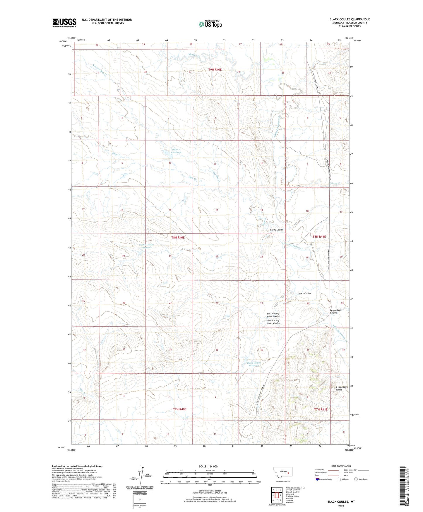
2024 topographic map quadrangle Black Coulee in the state of Montana. Scale: 1:24000. Based on the newly updated USGS 7.5' US Topo map series, this map is in the following counties: Rosebud. The map contains contour data, water features, and other items you are used to seeing on USGS maps, but also has updated roads and other features. This is the next generation of topographic maps. Printed on high-quality waterproof paper with UV fade-resistant inks.
Quads adjacent to this one:
West: Finch NE
Northwest: Flat Bottom Coulee SE
North: Rough Creek SW
Northeast: Rough Creek SE
East: Schultz Coulee
Southeast: Orinoco
South: Forsyth
Southwest: Nichols
This map covers the same area as the classic USGS quad with code o46106d6.
Contains the following named places: Black Coulee, Black Coulee Reservoir, Black Coulee Reservoir Dam, Cherry Creek, Corny Coulee, Corny Coulee Reservoir, Gruner School, Hay Creek, Hay Creek Reservoir, Hay Creek Reservoir Dam, Hillside School, Little Porcupine School, North Prong Black Coulee, North Prong Hay Creek, Porcupine Lookout, Schoolmarm Buttes, Sims Number 1 Dam, South Prong Black Coulee, Stellar Creek, Wagon Box Coulee