MyTopo
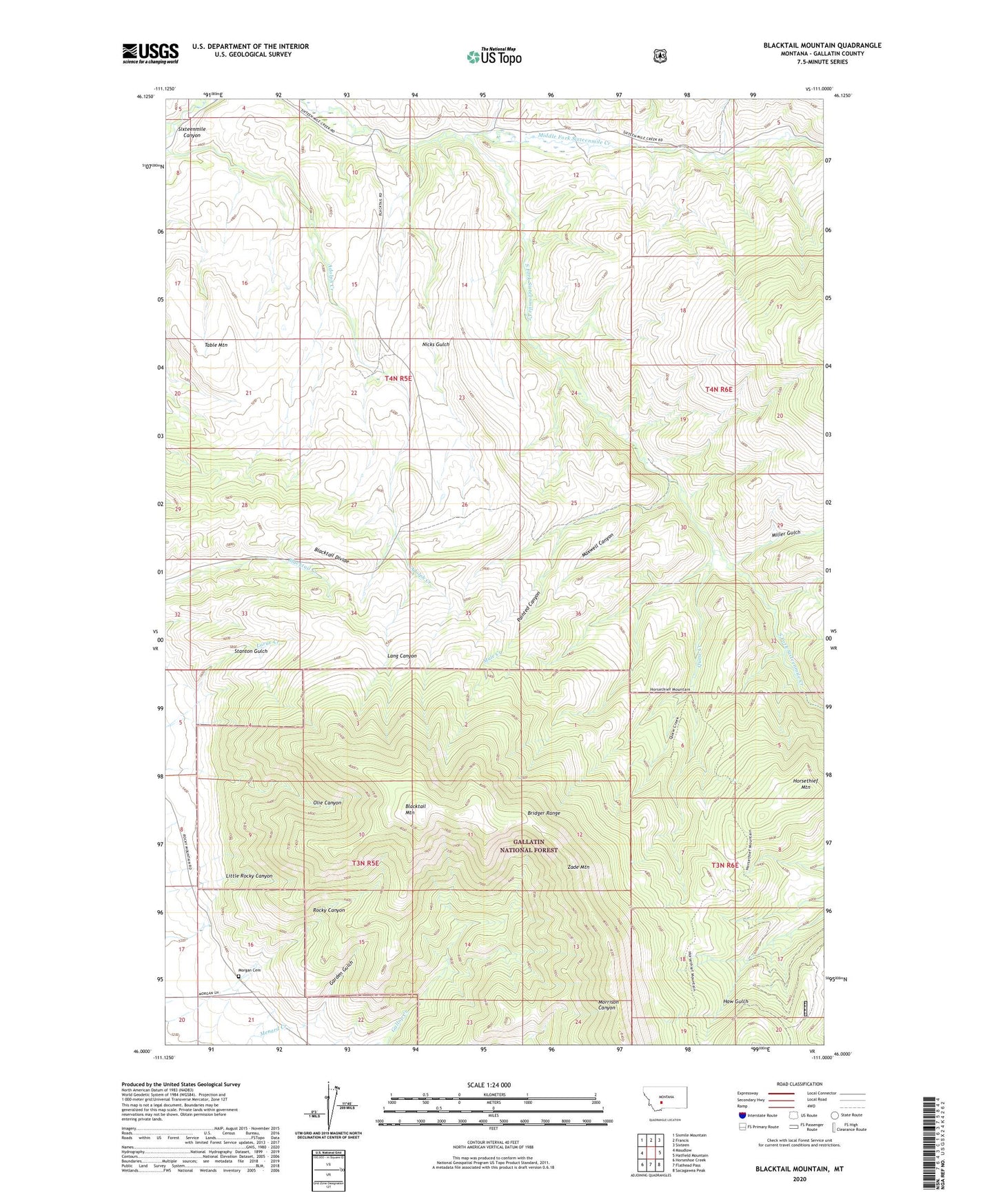
Blacktail Mountain Montana US Topo Map
Couldn't load pickup availability
Also explore the Blacktail Mountain Forest Service Topo of this same quad for updated USFS data
2024 topographic map quadrangle Blacktail Mountain in the state of Montana. Scale: 1:24000. Based on the newly updated USGS 7.5' US Topo map series, this map is in the following counties: Gallatin. The map contains contour data, water features, and other items you are used to seeing on USGS maps, but also has updated roads and other features. This is the next generation of topographic maps. Printed on high-quality waterproof paper with UV fade-resistant inks.
Quads adjacent to this one:
West: Maudlow
Northwest: Sixmile Mountain
North: Francis
Northeast: Sixteen
East: Hatfield Mountain
Southeast: Sacagawea Peak
South: Flathead Pass
Southwest: Horseshoe Creek
This map covers the same area as the classic USGS quad with code o46111a1.
Contains the following named places: Adolph Creek, Blacktail Divide, Blacktail Mountain, Garden Gulch, Hatfield Ranch, Horsethief Mountain, Jensen Ranch, Josephine School, Lang Canyon, Little Rocky Canyon, Maxwell Canyon, Miller Gulch, Morgan Cemetery, Morgan Ranch, Mule Creek, Nicks Gulch, Olie Canyon, Painted Canyon, Quaw Creek, Rocky Canyon, South Fork Sixteenmile Creek, Stanton Gulch, Table Mountain, Zade Mountain