MyTopo
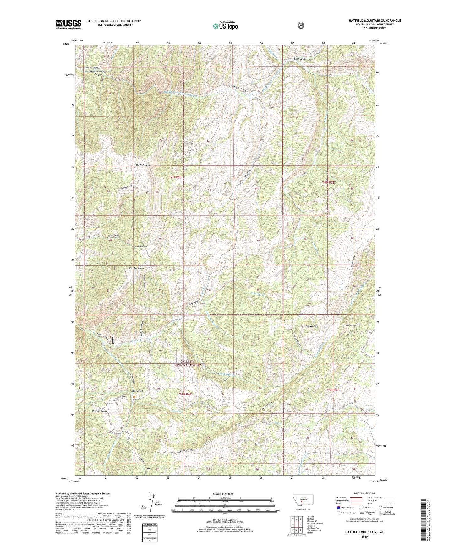
Hatfield Mountain Montana US Topo Map
Couldn't load pickup availability
Also explore the Hatfield Mountain Forest Service Topo of this same quad for updated USFS data
2024 topographic map quadrangle Hatfield Mountain in the state of Montana. Scale: 1:24000. Based on the newly updated USGS 7.5' US Topo map series, this map is in the following counties: Gallatin. The map contains contour data, water features, and other items you are used to seeing on USGS maps, but also has updated roads and other features. This is the next generation of topographic maps. Printed on high-quality waterproof paper with UV fade-resistant inks.
Quads adjacent to this one:
West: Blacktail Mountain
Northwest: Francis
North: Sixteen
Northeast: Sixteen NE
East: Wallrock
Southeast: Sedan
South: Sacagawea Peak
Southwest: Flathead Pass
This map covers the same area as the classic USGS quad with code o46110a8.
Contains the following named places: Bearskull Creek, Coal Gulch, Cow Creek, Dry Fork, Elkhorn Ridge, Fleming, Grouse Mountain, Hatfield Mountain, Haw Gulch, Hayfield Creek, Lincoln School, Middle Fork Canyon, Miller Ranch, Red Rock Mountain, Running Deer Creek, Snowslide Creek, South Fork Trail, Timber Creek, Troy Creek, Troy Ranger Station