MyTopo
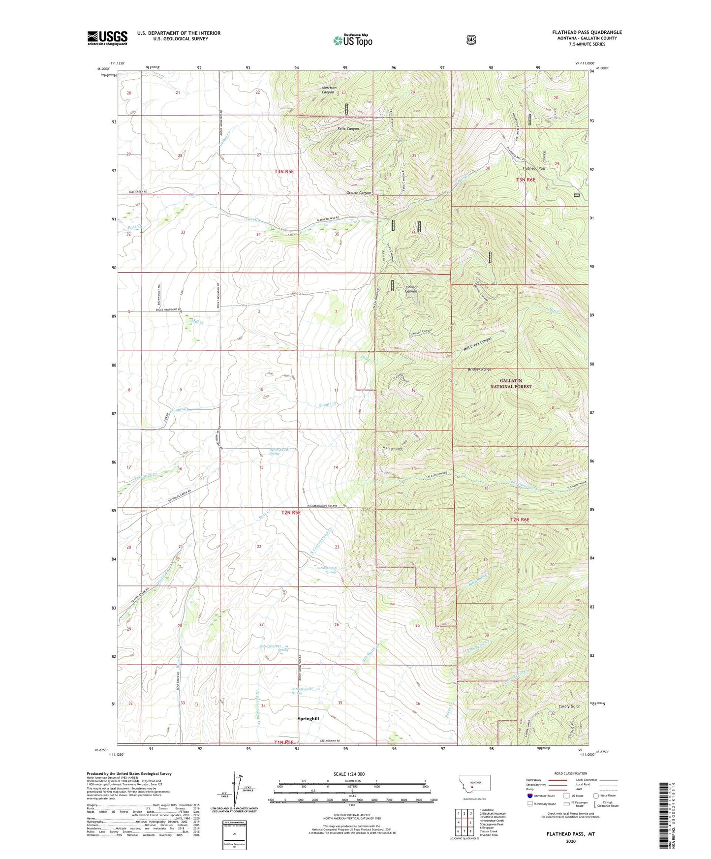
Flathead Pass Montana US Topo Map
Couldn't load pickup availability
Also explore the Flathead Pass Forest Service Topo of this same quad for updated USFS data
2024 topographic map quadrangle Flathead Pass in the state of Montana. Scale: 1:24000. Based on the newly updated USGS 7.5' US Topo map series, this map is in the following counties: Gallatin. The map contains contour data, water features, and other items you are used to seeing on USGS maps, but also has updated roads and other features. This is the next generation of topographic maps. Printed on high-quality waterproof paper with UV fade-resistant inks.
Quads adjacent to this one:
West: Horseshoe Creek
Northwest: Maudlow
North: Blacktail Mountain
Northeast: Hatfield Mountain
East: Sacagawea Peak
Southeast: Saddle Peak
South: Miser Creek
Southwest: Belgrade
This map covers the same area as the classic USGS quad with code o45111h1.
Contains the following named places: 02N05E04DADD01 Well, 02N05E10BDBD01 Well, 02N05E15AC__01 Spring, 02N05E21BBCC01 Well, 02N05E22DDAD01 Well, 02N05E23CD__01 Spring, 02N05E27DD__01 Spring, 02N05E28CD__01 Well, 02N05E33BD__01 Well, 02N05E33CA__01 Well, 02N05E34AD__01 Spring, 02N05E34DA__01 Well, 02N05E34DDBB01 Well, 02N05E34DDC_01 Well, 02N05E34DDD_01 Well, 02N05E35BA__01 Well, 03N05E28DD__01 Well, Belgrade Division, Central Valley Fire District Station 4, Duncan Post Office, Evan Reese Creek, Felix Canyon, Flathead Pass, Gallop, Gallop Creek, Gallop Post Office, Grouse Canyon, Johnson Canyon, Mill Creek Canyon, Morrison Canyon, Mountain View School, Pass Creek Mine, Pass Creek School, Reese Creek School, Sept Morn Mine, Springhill Census Designated Place, Stock Drive Trail, Tom Reese Creek