MyTopo
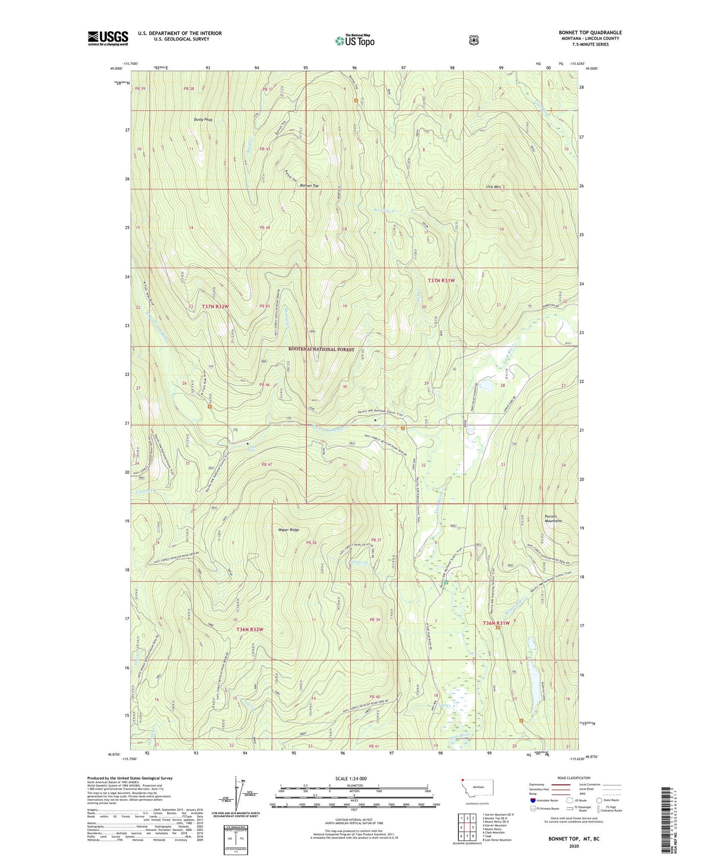
Bonnet Top Montana US Topo Map
Couldn't load pickup availability
Also explore the Bonnet Top Forest Service Topo of this same quad for updated USFS data
2024 topographic map quadrangle Bonnet Top in the state of Montana. Scale: 1:24000. Based on the newly updated USGS 7.5' US Topo map series, this map is in the following counties: Lincoln. The map contains contour data, water features, and other items you are used to seeing on USGS maps, but also has updated roads and other features. This is the next generation of topographic maps. Printed on high-quality waterproof paper with UV fade-resistant inks.
Quads adjacent to this one:
West: Garver Mountain
Northwest: Garver Mountain OE N
North: Bonnet Top OE N
Northeast: Mount Henry OE N
East: Mount Henry
Southeast: Lost Horse Mountain
South: Yaak
Southwest: Clark Mountain
This map covers the same area as the classic USGS quad with code o48115h6.
Contains the following named places: 36N31W06AACA01 Well, Benefield Creek, Bonnet Top, Bunker Hill Creek, Carlisle Dam, Dusty Peak, French Creek, Hoskins Lake, Koo Koo Creek, Lick Mountain, Lower Falls, Sink Creek, Upper Falls, Upper Ford Guard Station, Waper Creek, Waper Ridge, West Fork Yaak River, Yaak Valley Church