MyTopo
Garver Mountain Montana US Topo Map
Couldn't load pickup availability
Also explore the Garver Mountain Forest Service Topo of this same quad for updated USFS data
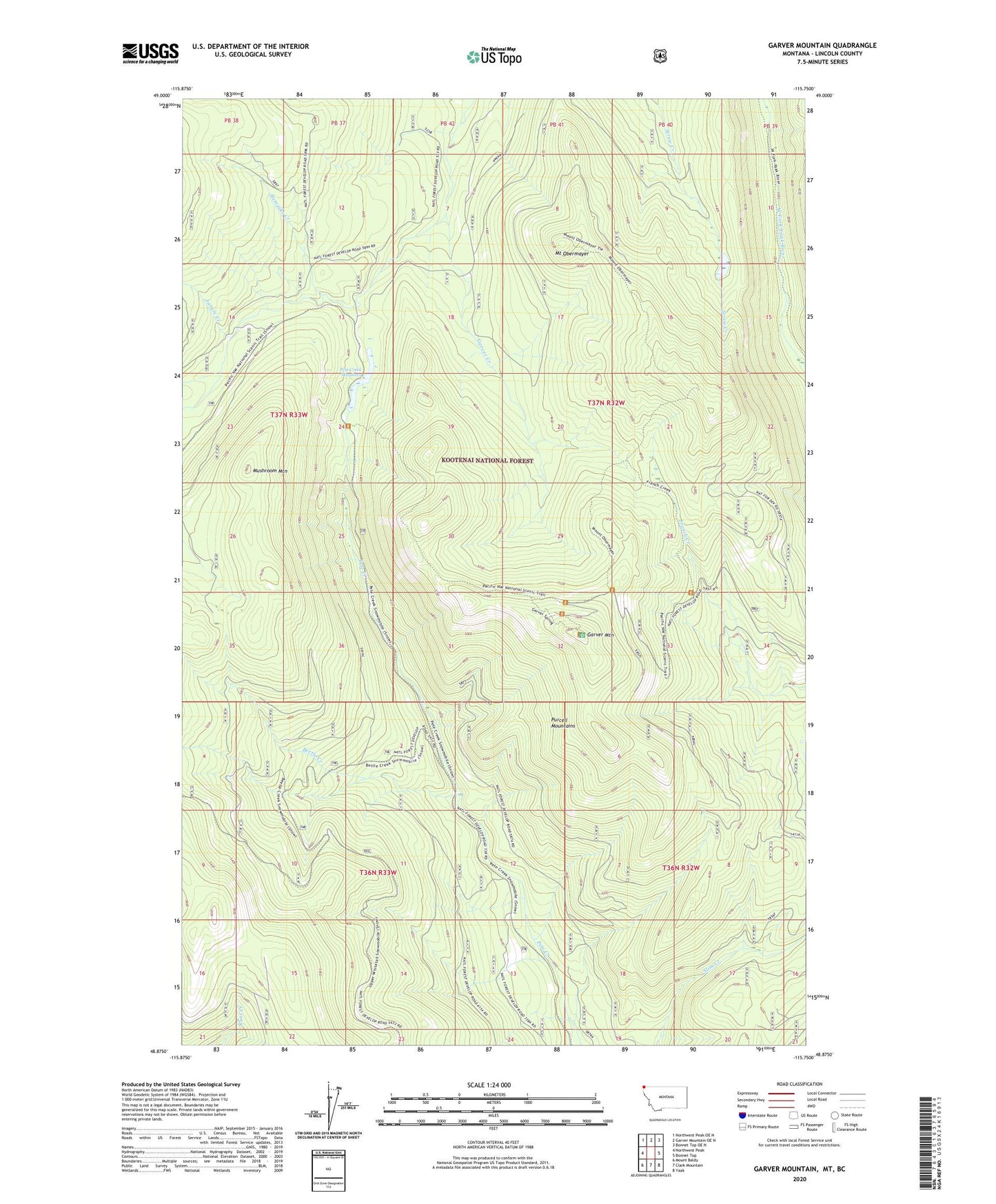
2024 topographic map quadrangle Garver Mountain in the state of Montana. Scale: 1:24000. Based on the newly updated USGS 7.5' US Topo map series, this map is in the following counties: Lincoln. The map contains contour data, water features, and other items you are used to seeing on USGS maps, but also has updated roads and other features. This is the next generation of topographic maps. Printed on high-quality waterproof paper with UV fade-resistant inks.
Quads adjacent to this one:
West: Northwest Peak
Northwest: Northwest Peak OE N
North: Garver Mountain OE N
Northeast: Bonnet Top OE N
East: Bonnet Top
Southeast: Yaak
South: Clark Mountain
Southwest: Mount Baldy
This map covers the same area as the classic USGS quad with code o48115h7.
Contains the following named places: Beetle Creek, Garver Creek, Garver Creek Snow Gage, Garver Mountain, Garver Mountain Lookout Tower, Jungle Creek, Mount Obermayer, Mushroom Mountain, Pete Creek Camp, Pete Creek Meadows, Rampike Creek