MyTopo
Yaak Montana US Topo Map
Couldn't load pickup availability
Also explore the Yaak Forest Service Topo of this same quad for updated USFS data
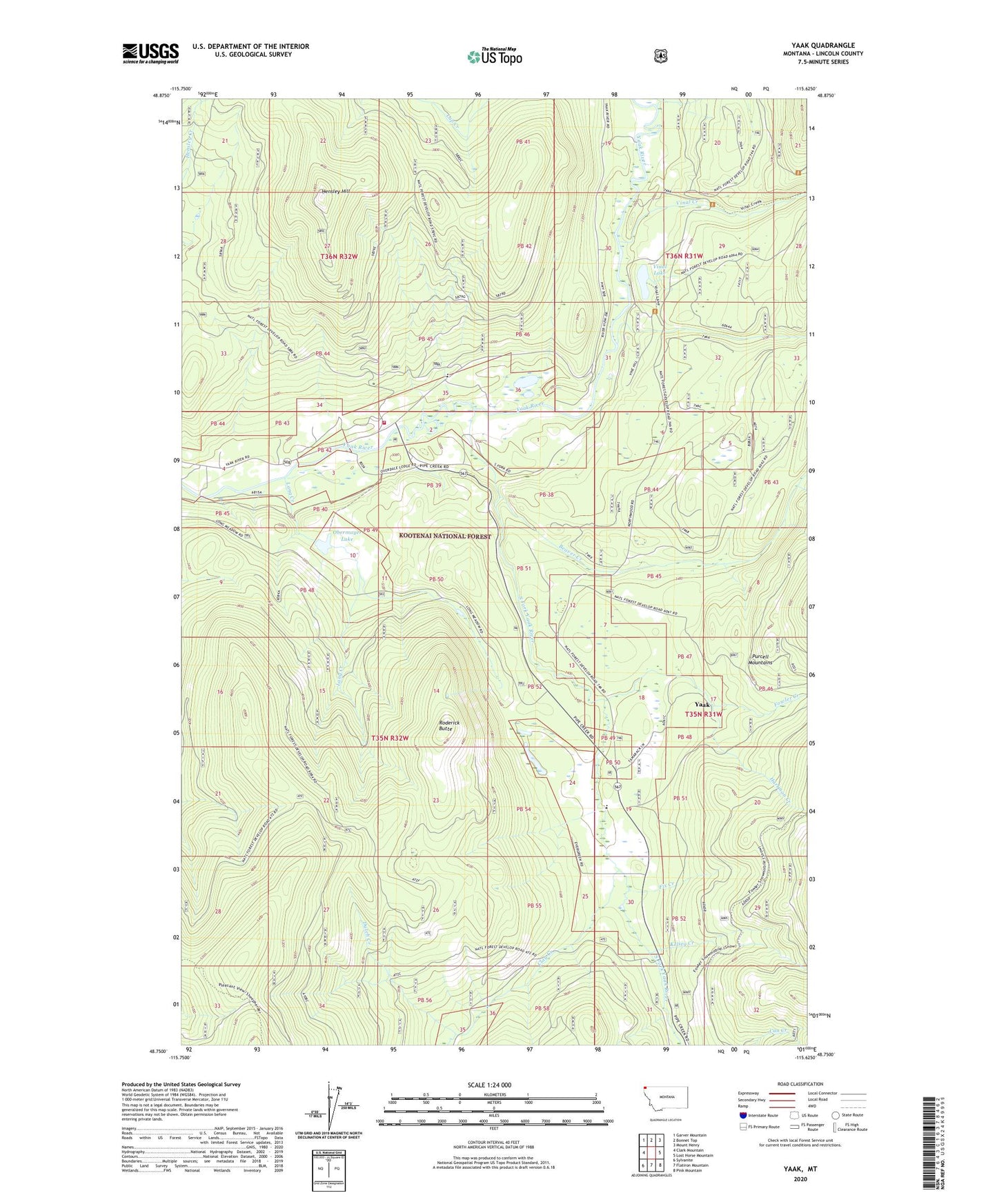
2024 topographic map quadrangle Yaak in the state of Montana. Scale: 1:24000. Based on the newly updated USGS 7.5' US Topo map series, this map is in the following counties: Lincoln. The map contains contour data, water features, and other items you are used to seeing on USGS maps, but also has updated roads and other features. This is the next generation of topographic maps. Printed on high-quality waterproof paper with UV fade-resistant inks.
Quads adjacent to this one:
West: Clark Mountain
Northwest: Garver Mountain
North: Bonnet Top
Northeast: Mount Henry
East: Lost Horse Mountain
Southeast: Pink Mountain
South: Flatiron Mountain
Southwest: Sylvanite
This map covers the same area as the classic USGS quad with code o48115g6.
Contains the following named places: Beaver Creek, Browning Creek, Clay Creek, Dutch Creek, Fix Creek, Fowler Creek, Hartman Creek, Hensley Hill, Kelsey Creek, Lang Creek, Lap Creek, Obermayer Lake, Obermayer Lake Dam, Roderick Butte, South Fork Yaak River, Taylor Post Office, Vinal Creek, Vinal Lake, Yaak, Yaak Air Force Station, Yaak Census Designated Place, Yaak Community Center, Yaak Mine, Yaak Post Office, Yaak School, Yaak Volunteer Fire Department