MyTopo
Boston Coulee School Montana US Topo Map
Couldn't load pickup availability
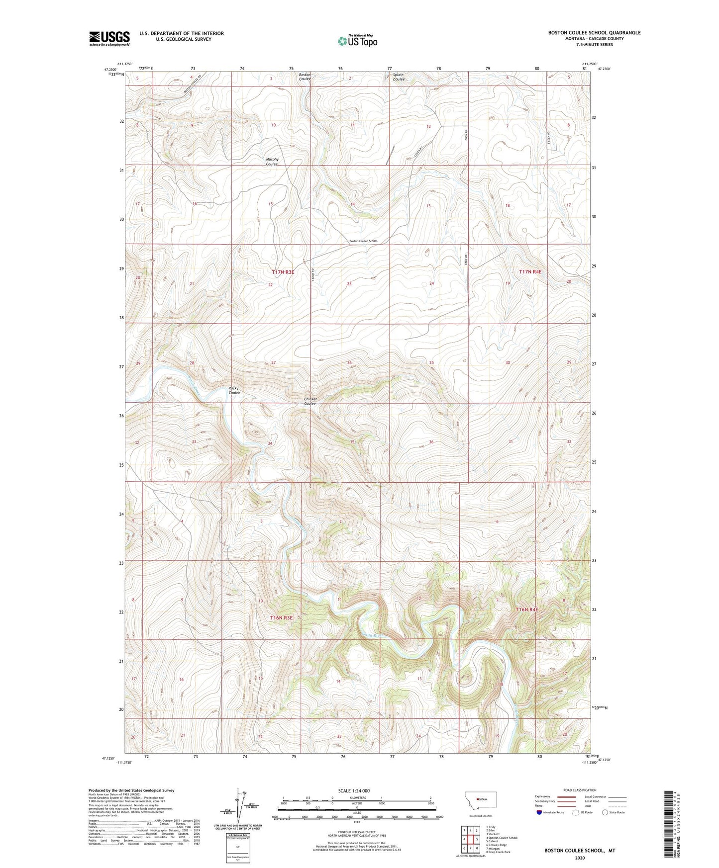
2020 topographic map quadrangle Boston Coulee School in the state of Montana. Scale: 1:24000. Based on the newly updated USGS 7.5' US Topo map series, this map is in the following counties: Cascade. The map contains contour data, water features, and other items you are used to seeing on USGS maps, but also has updated roads and other features. This is the next generation of topographic maps. Printed on high-quality waterproof paper with UV fade-resistant inks.
Quads adjacent to this one:
West: Spanish Coulee School
Northwest: Truly
North: Eden
Northeast: Stockett
East: Calvert
Southeast: Deep Creek Park
South: Millegan
Southwest: Conway Ridge
Contains the following named places: 17N03E14D___01 Well, 17N03E22D___01 Well, 17N03E24A___01 Well, 17N03E24CC__01 Well, 17N03E24D___01 Well, 17N03E26AD__01 Well, Boston Coulee School, Chicken Coulee, Hanger School, Meisenbach School, Reverse 5 Bar M Airport, Rocky Coulee