MyTopo
Spanish Coulee School Montana US Topo Map
Couldn't load pickup availability
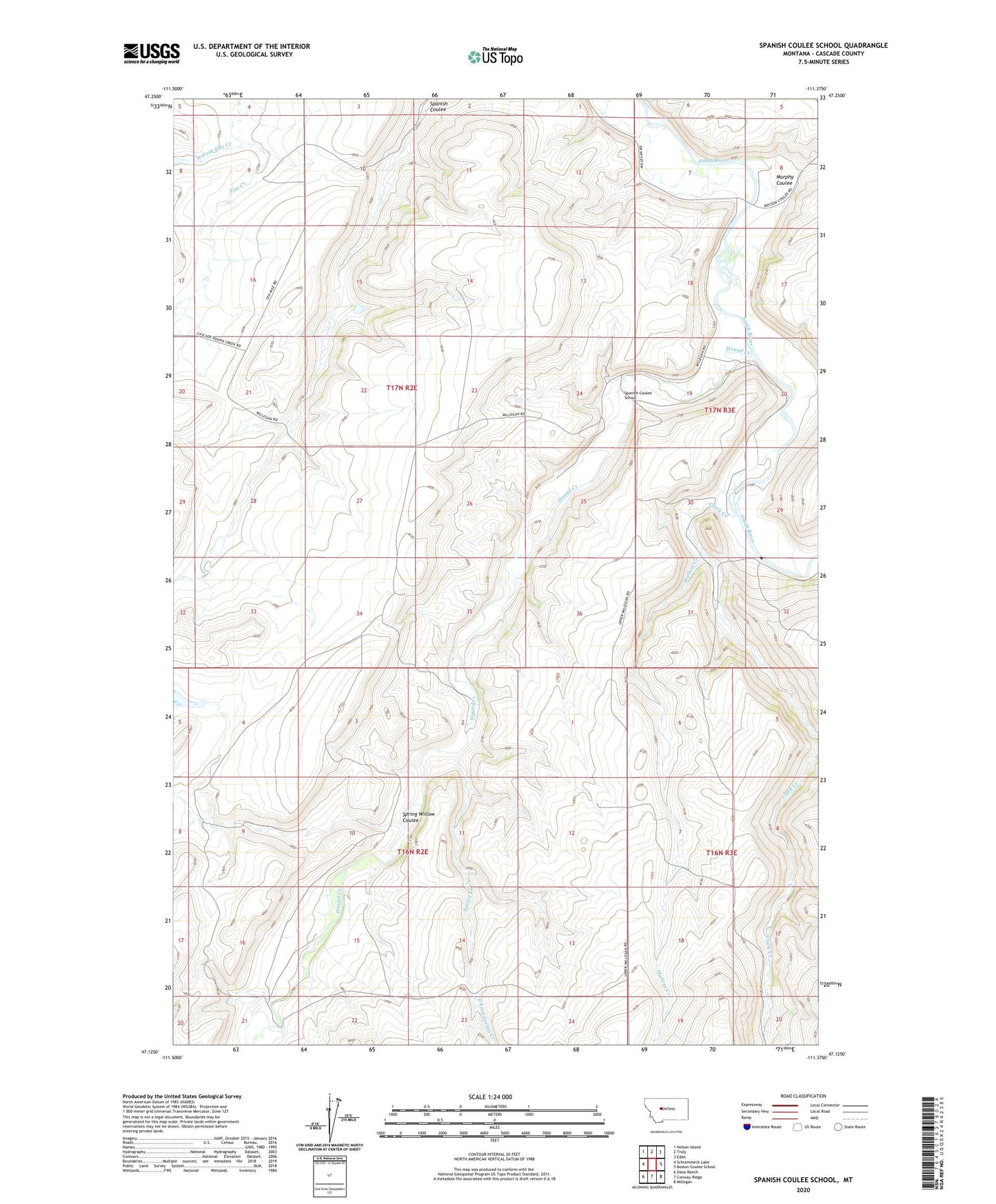
2024 topographic map quadrangle Spanish Coulee School in the state of Montana. Scale: 1:24000. Based on the newly updated USGS 7.5' US Topo map series, this map is in the following counties: Cascade. The map contains contour data, water features, and other items you are used to seeing on USGS maps, but also has updated roads and other features. This is the next generation of topographic maps. Printed on high-quality waterproof paper with UV fade-resistant inks.
Quads adjacent to this one:
West: Schrammeck Lake
Northwest: Nelson Island
North: Truly
Northeast: Eden
East: Boston Coulee School
Southeast: Millegan
South: Conway Ridge
Southwest: Dana Ranch
This map covers the same area as the classic USGS quad with code o47111b4.
Contains the following named places: 17N02E02DD__01 Well, 17N02E09D___01 Spring, 17N02E09D___02 Well, 17N02E10A___01 Spring, 17N02E10A___02 Well, 17N02E15D___01 Spring, 17N02E24D___01 Well, 17N02E24D___02 Well, 17N02E28B___01 Well, 17N02E34A___01 Well, 17N02E34A___02 Well, 17N03E08B___01 Well, 17N03E08C___01 Well, 17N03E30____01 Well, 17N03E30____02 Well, Clark Creek, East Fork Spring Creek, Hound Creek, Hound Creek School, Leveque Reservoir Dam, Mesaros Dam, Mullens Creek, Murphy Coulee, Orr Post Office, Spaniard Dam, Spanish Coulee School, Spring Creek, Spring Willow Coulee, West Fork Flat Creek