MyTopo
Conway Ridge Montana US Topo Map
Couldn't load pickup availability
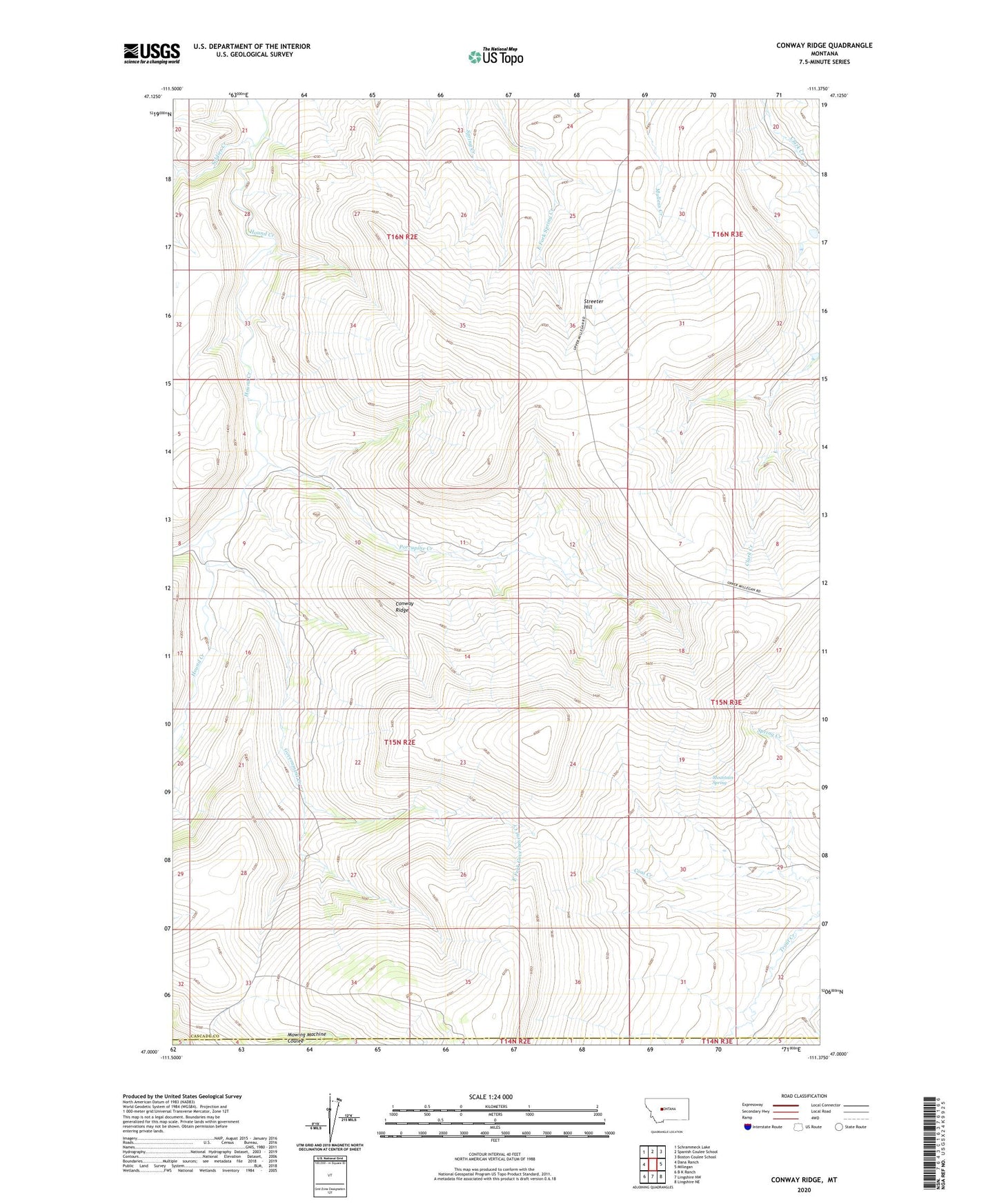
2024 topographic map quadrangle Conway Ridge in the state of Montana. Scale: 1:24000. Based on the newly updated USGS 7.5' US Topo map series, this map is in the following counties: Cascade, Meagher. The map contains contour data, water features, and other items you are used to seeing on USGS maps, but also has updated roads and other features. This is the next generation of topographic maps. Printed on high-quality waterproof paper with UV fade-resistant inks.
Quads adjacent to this one:
West: Dana Ranch
Northwest: Schrammeck Lake
North: Spanish Coulee School
Northeast: Boston Coulee School
East: Millegan
Southeast: Lingshire NE
South: Lingshire NW
Southwest: B K Ranch
This map covers the same area as the classic USGS quad with code o47111a4.
Contains the following named places: Carter School, Conway Ridge, East Fork Government Creek, Government Creek, McKamey Dam, Mountain Spring, Mullery Creek, Porcupine Creek, Soldier Creek, Streeter Hill, West Fork Hound Creek