MyTopo
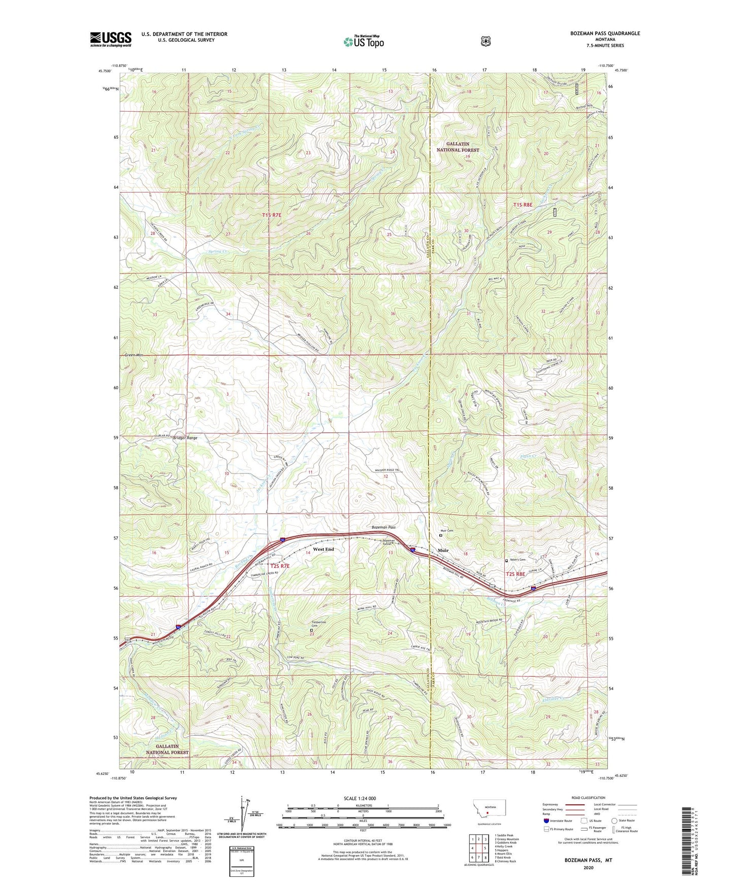
Bozeman Pass Montana US Topo Map
Couldn't load pickup availability
Also explore the Bozeman Pass Forest Service Topo of this same quad for updated USFS data
2024 topographic map quadrangle Bozeman Pass in the state of Montana. Scale: 1:24000. Based on the newly updated USGS 7.5' US Topo map series, this map is in the following counties: Gallatin, Park. The map contains contour data, water features, and other items you are used to seeing on USGS maps, but also has updated roads and other features. This is the next generation of topographic maps. Printed on high-quality waterproof paper with UV fade-resistant inks.
Quads adjacent to this one:
West: Kelly Creek
Northwest: Saddle Peak
North: Grassy Mountain
Northeast: Gobblers Knob
East: Hoppers
Southeast: Chimney Rock
South: Bald Knob
Southwest: Mount Ellis
This map covers the same area as the classic USGS quad with code o45110f7.
Contains the following named places: Anaconda Copper Mines, Bozeman Pass, Bozeman Pass Historical Marker, Bozeman Tunnel, Buckskin Mine, Coulston, Coulston Mine, Di Lulo Mine, Doyle Cabin, Five Mine, Goose Creek, Green Mountain, Hudson Creek, Jackson Creek, KCTZ-TV (Bozeman), KUUB-FM (Bozeman), KYBS-FM (Livingston), Malmborg School, Meadow Creek, Meadow Creek School, Miller Mine, Mountain Side, Mountainside Mine, Muir, Muir Cemetery, Muir Post Office, Muir School, Murphy Mine, North Fork Spring Creek, Number Four Mine, Number Thirty Mine, Quinn Creek, Radke Sawmill, Ross Mine, Shadoan Sawmill, Stinking Water Mine, Storrs, Storrs Mine, Storrs Post Office, Storrs School, Timberline, Timberline Cemetery, Timberline Creek, Timberline Post Office, Upper Ross Mine, Vater's Cemetery, Vaters Post Office, Vaters School, West End, Woodland Mine