MyTopo
Grassy Mountain Montana US Topo Map
Couldn't load pickup availability
Also explore the Grassy Mountain Forest Service Topo of this same quad for updated USFS data
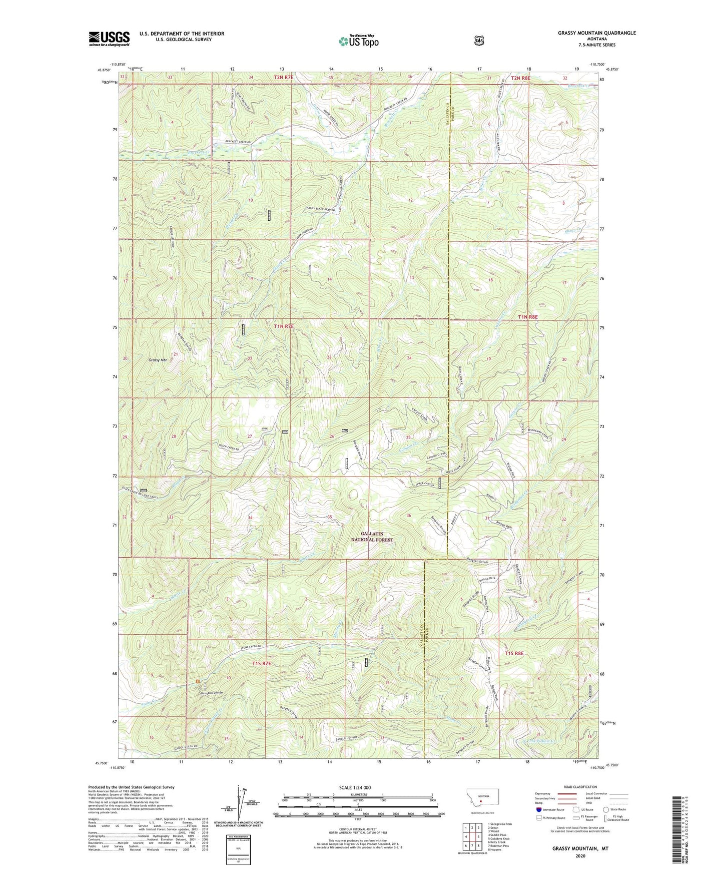
2024 topographic map quadrangle Grassy Mountain in the state of Montana. Scale: 1:24000. Based on the newly updated USGS 7.5' US Topo map series, this map is in the following counties: Gallatin, Park. The map contains contour data, water features, and other items you are used to seeing on USGS maps, but also has updated roads and other features. This is the next generation of topographic maps. Printed on high-quality waterproof paper with UV fade-resistant inks.
Quads adjacent to this one:
West: Saddle Peak
Northwest: Sacagawea Peak
North: Sedan
Northeast: Wilsall
East: Gobblers Knob
Southeast: Hoppers
South: Bozeman Pass
Southwest: Kelly Creek
This map covers the same area as the classic USGS quad with code o45110g7.
Contains the following named places: Bangtail Ranger Station, Bangtail Trail, Bishop Park, Grassy Mountain, Horse Creek, Miles Creek, Moody Creek, Skunk Creek, Weasel Creek