MyTopo
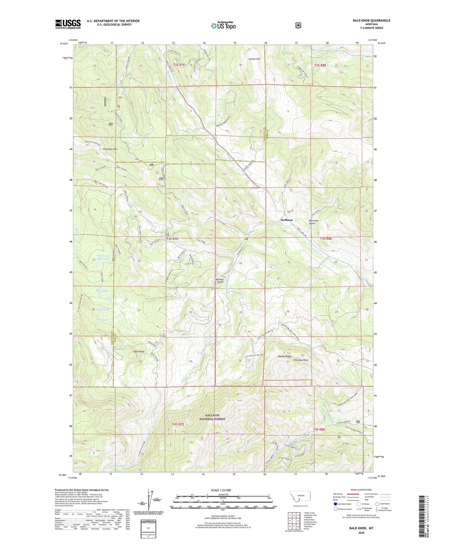
Bald Knob Montana US Topo Map
Couldn't load pickup availability
Also explore the Bald Knob Forest Service Topo of this same quad for updated USFS data
2024 topographic map quadrangle Bald Knob in the state of Montana. Scale: 1:24000. Based on the newly updated USGS 7.5' US Topo map series, this map is in the following counties: Park, Gallatin. The map contains contour data, water features, and other items you are used to seeing on USGS maps, but also has updated roads and other features. This is the next generation of topographic maps. Printed on high-quality waterproof paper with UV fade-resistant inks.
Quads adjacent to this one:
West: Mount Ellis
Northwest: Kelly Creek
North: Bozeman Pass
Northeast: Hoppers
East: Chimney Rock
Southeast: Pray
South: Big Draw
Southwest: Fridley Peak
This map covers the same area as the classic USGS quad with code o45110e7.
Contains the following named places: Bald Knob, Bear Lakes, Benolken Ranch, Browns Gulch, Center Hill, Chimney Rock, Cold Spring, Crystal Lake, Elliott Ranch, Gasoway, Harrison Mine, Hoffman, Hoffman Post Office, Kountz, Kountz Mine, Maxey Ridge, McReynolds Ranch, Morrison Gulch, North Fork Pine Creek, North Fork Trail Creek, Old Cooper Reservoir, Old Russell Mine, Pine Lake, Safely, Summit, Thomae Ranch, Trail Creek Guard Station