MyTopo
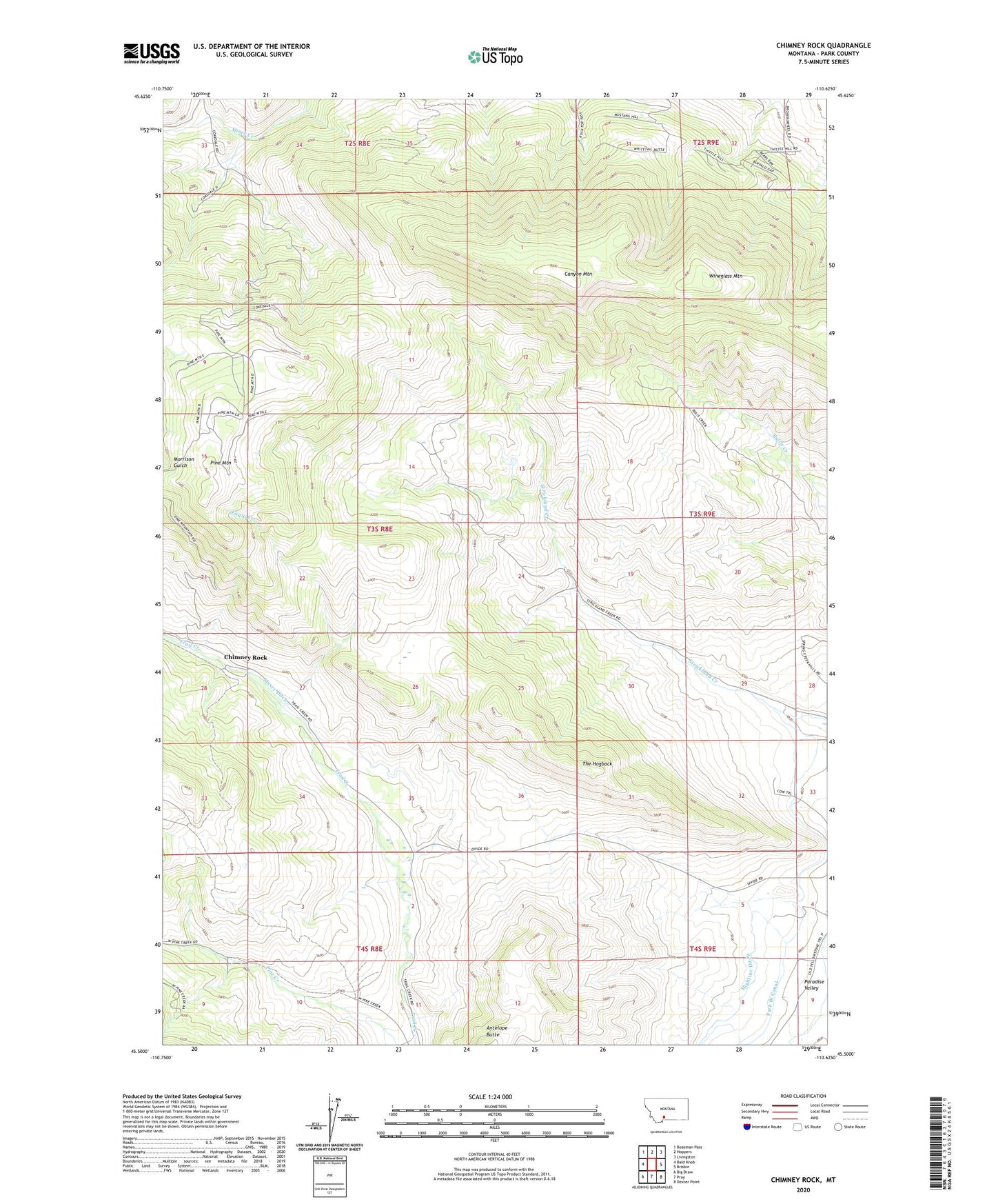
Chimney Rock Montana US Topo Map
Couldn't load pickup availability
Also explore the Chimney Rock Forest Service Topo of this same quad for updated USFS data
2024 topographic map quadrangle Chimney Rock in the state of Montana. Scale: 1:24000. Based on the newly updated USGS 7.5' US Topo map series, this map is in the following counties: Park. The map contains contour data, water features, and other items you are used to seeing on USGS maps, but also has updated roads and other features. This is the next generation of topographic maps. Printed on high-quality waterproof paper with UV fade-resistant inks.
Quads adjacent to this one:
West: Bald Knob
Northwest: Bozeman Pass
North: Hoppers
Northeast: Livingston
East: Brisbin
Southeast: Dexter Point
South: Pray
Southwest: Big Draw
This map covers the same area as the classic USGS quad with code o45110e6.
Contains the following named places: Blome Ranch, Canyon Mountain, Chimney Rock, Chimney Rock School, Chimneyrock, Chimneyrock Post Office, Eagle Creek, Hoffman School, Maxey Ditch, Maxey Mine, Maxey Mines, Nesbit Ranch, Pine Mountain, The Hogback, Wineglass Mountain