MyTopo
Ismay South Montana US Topo Map
Couldn't load pickup availability
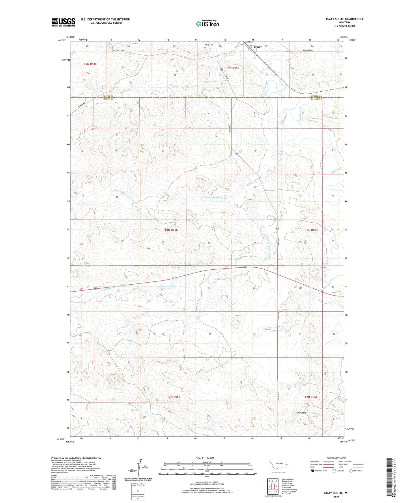
2024 topographic map quadrangle Ismay South in the state of Montana. Scale: 1:24000. Based on the newly updated USGS 7.5' US Topo map series, this map is in the following counties: Fallon, Custer. The map contains contour data, water features, and other items you are used to seeing on USGS maps, but also has updated roads and other features. This is the next generation of topographic maps. Printed on high-quality waterproof paper with UV fade-resistant inks.
Quads adjacent to this one:
West: Bracket Butte
Northwest: Loony Hollow
North: Ismay North
Northeast: Ayer Spring
East: Westmore
Southeast: T G Creek
South: Bracket Butte SE
Southwest: Foundation Spring
This map covers the same area as the classic USGS quad with code o46104d7.
Contains the following named places: 07N55E02BC__01 Well, 07N55E03DA__01 Well, 07N56E05BA__01 Well, 07N56E08AB__01 Well, 08N55E01DABA01 Well, 08N55E13ABBD01 Well, 08N55E25AA__01 Well, Cottonwood Creek, Hay Creek, Hough Dam, Ismay, Ismay Cemetery, Ismay Grain Company Elevator, Ismay Post Office, North Fork Cottonwood Creek, Rieger Dam, Sandstone Creek, South Fork Cottonwood Creek, Station Creek, Twin Buttes