MyTopo
Crain Place Montana US Topo Map
Couldn't load pickup availability
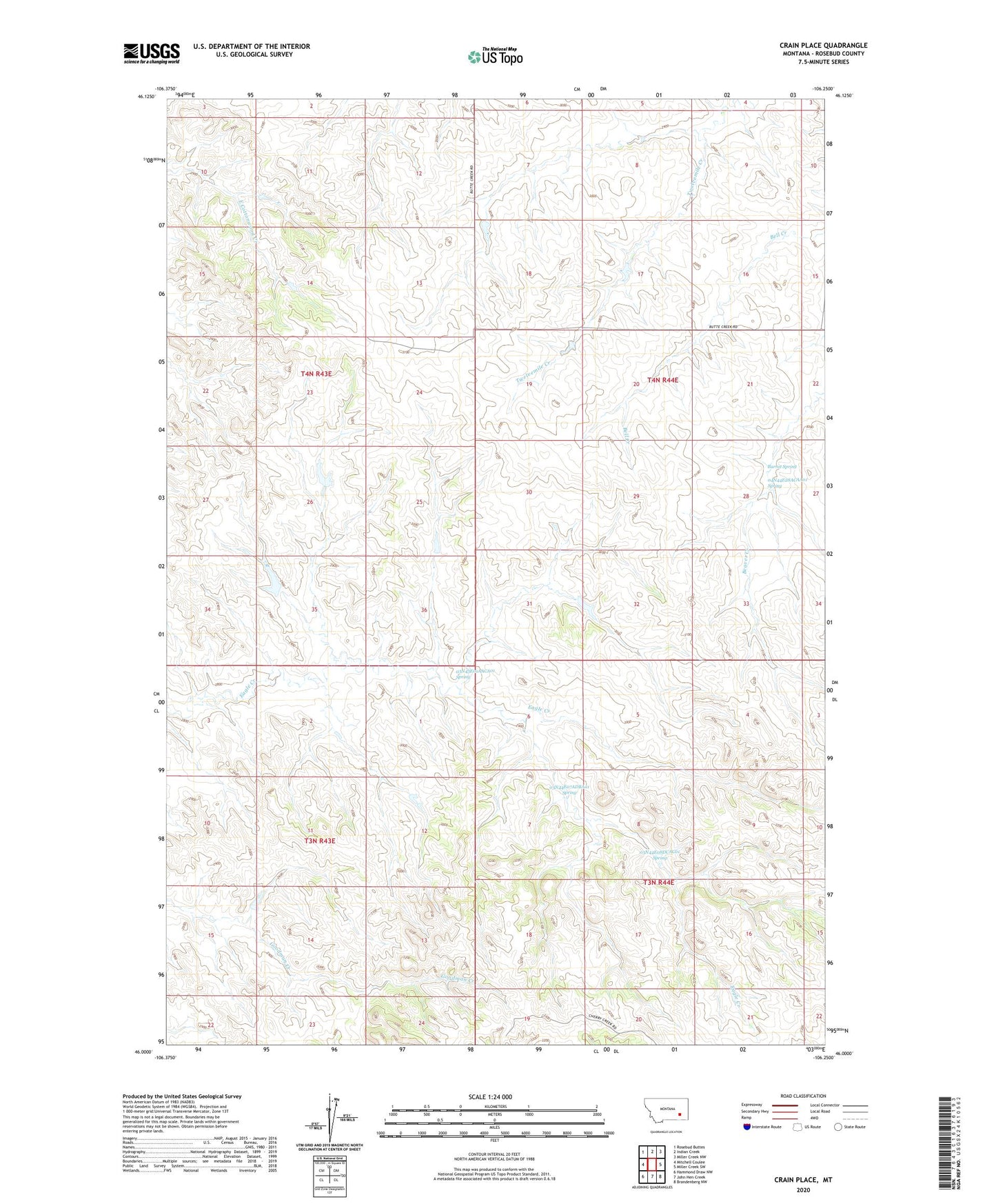
2024 topographic map quadrangle Crain Place in the state of Montana. Scale: 1:24000. Based on the newly updated USGS 7.5' US Topo map series, this map is in the following counties: Rosebud. The map contains contour data, water features, and other items you are used to seeing on USGS maps, but also has updated roads and other features. This is the next generation of topographic maps. Printed on high-quality waterproof paper with UV fade-resistant inks.
Quads adjacent to this one:
West: Mitchell Coulee
Northwest: Rosebud Buttes
North: Indian Creek
Northeast: Miller Creek NW
East: Miller Creek SW
Southeast: Brandenberg NW
South: John Hen Creek
Southwest: Hammond Draw NW
This map covers the same area as the classic USGS quad with code o46106a3.
Contains the following named places: 03N43E01AACA01 Spring, 03N43E03ACCB01 Well, 03N43E15BADD01 Well, 03N44E06BDCD01 Well, 03N44E07ADBA01 Spring, 03N44E08DCAC01 Spring, 03N44E17AABB01 Well, 03N44E18AABA01 Well, 04N43E24BAAD01 Well, 04N44E28ACAA01 Spring, 04N44E28ACDD01 Well, 04N44E29CCAC01 Well, 04N44E32DDDA01 Well, Barrot Spring, Beaver Creek, Clark Number 2 Dam, Crain Place, Dunning Number 1 Dam, Dunning Number 2 Dam, Lincoln School, Mees Number 1 Dam, Sweeney Post Office