MyTopo
Line Coulee Montana US Topo Map
Couldn't load pickup availability
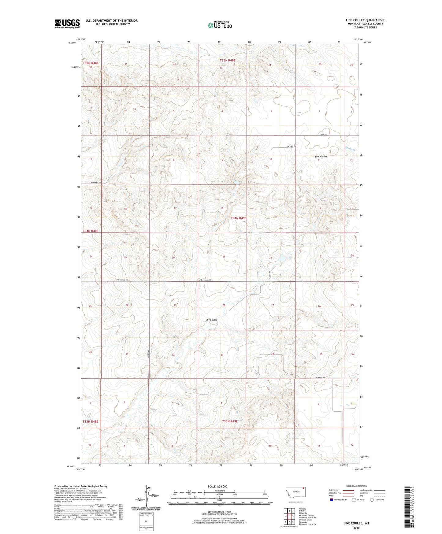
2024 topographic map quadrangle Line Coulee in the state of Montana. Scale: 1:24000. Based on the newly updated USGS 7.5' US Topo map series, this map is in the following counties: Daniels. The map contains contour data, water features, and other items you are used to seeing on USGS maps, but also has updated roads and other features. This is the next generation of topographic maps. Printed on high-quality waterproof paper with UV fade-resistant inks.
Quads adjacent to this one:
West: Cabarett Coulee
Northwest: Scobey
North: Madoc
Northeast: Flaxville
East: Pleasant Prairie NW
Southeast: Pleasant Prairie SW
South: Bredette
Southwest: Nielsen Coulee
This map covers the same area as the classic USGS quad with code o48105f3.
Contains the following named places: 34N49E22CADB01 Well, 34N49E22CADB02 Well, 34N49E22CCAA01 Well, 34N49E22CCAA02 Well, 34N49E22DCCC01 Well, 34N49E27BAAB01 Well, 34N49E27BABC01 Well, 34N49E30BBBB01 Well, 34N49E33CABB01 Well, 34S49E18ABCC01 Well, 35N49E32BBDB01 Well, 35N49E33ADBB01 Well, 35N49E34DDDA01 Well, Big Coulee, Danelson Reservoir Dam, Lindquest Number 1 Dam