MyTopo
Spring Creek Junction Montana US Topo Map
Couldn't load pickup availability
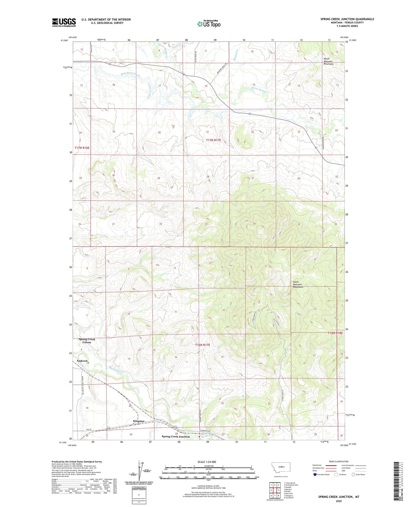
2024 topographic map quadrangle Spring Creek Junction in the state of Montana. Scale: 1:24000. Based on the newly updated USGS 7.5' US Topo map series, this map is in the following counties: Fergus. The map contains contour data, water features, and other items you are used to seeing on USGS maps, but also has updated roads and other features. This is the next generation of topographic maps. Printed on high-quality waterproof paper with UV fade-resistant inks.
Quads adjacent to this one:
West: Danvers
Northwest: Toney Bench
North: Seventytwo Hills
Northeast: Kendall
East: Brooks
Southeast: Lewistown
South: Glengarry
Southwest: Ross Fork
This map covers the same area as the classic USGS quad with code o47109b5.
Contains the following named places: 16N17E17BCD_01 Well, 16N17E18BAD_01 Well, 16N17E18BDDA01 Well, 16N17E19DCD_01 Well, 16N17E19DCD_02 Well, 16N17E21ADD_01 Well, 16N17E22DCD_01 Well, 16N17E28ABC_01 Well, 17N17E18DADB01 Well, Amherst, Bank Ranch Ditch, Cottonwood Creek, Crazy Creek Reservoir Dam, Duck Creek, Hutterisshe Society School, Kingston, Lincoln Ditch, McDonnell School, Meadow Creek, Petticoat Junction Dam, Shiny Mountain School, South Moccasin Mountains, Spring Creek Colony, Spring Creek Colony Census Designated Place, Spring Creek Colony School, Spring Creek Junction, Stahlville Post Office, Warm Spring Creek School