MyTopo
Bull Island Montana US Topo Map
Couldn't load pickup availability
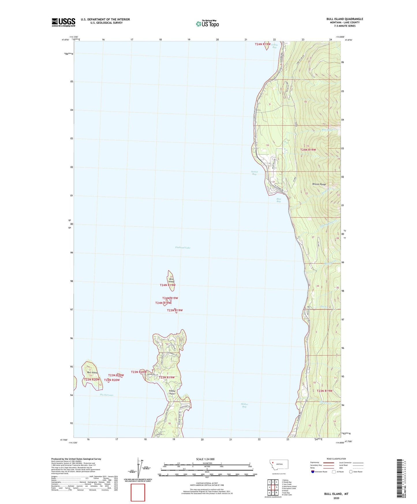
2024 topographic map quadrangle Bull Island in the state of Montana. Scale: 1:24000. Based on the newly updated USGS 7.5' US Topo map series, this map is in the following counties: Lake. The map contains contour data, water features, and other items you are used to seeing on USGS maps, but also has updated roads and other features. This is the next generation of topographic maps. Printed on high-quality waterproof paper with UV fade-resistant inks.
Quads adjacent to this one:
West: Wild Horse Island
Northwest: Rollins
North: Woods Bay
Northeast: Yew Creek
East: Porcupine Creek
Southeast: Cedar Lake
South: East Bay
Southwest: Polson
This map covers the same area as the classic USGS quad with code o47114g1.
Contains the following named places: 23N19W07BAAA01 Well, 23N19W07BDAC01 Well, 23N19W18ABB_01 Well, 23N19W18BDAC01 Well, 24N19W16DCA_01 Well, 24N19W21ACAA01 Well, Bird Island, Blue Bay, Blue Bay Creek, Boulder Creek, Bull Island, Dee Creek, Finley Point, Finley Point Campground, Flathead Lake State Park - Finley Point Unit, Skidoo Bay, Station Creek, Sunset Bay, Talking Water Creek, Teepee Creek, The Narrows, Yellow Bay