MyTopo
Wild Horse Island Montana US Topo Map
Couldn't load pickup availability
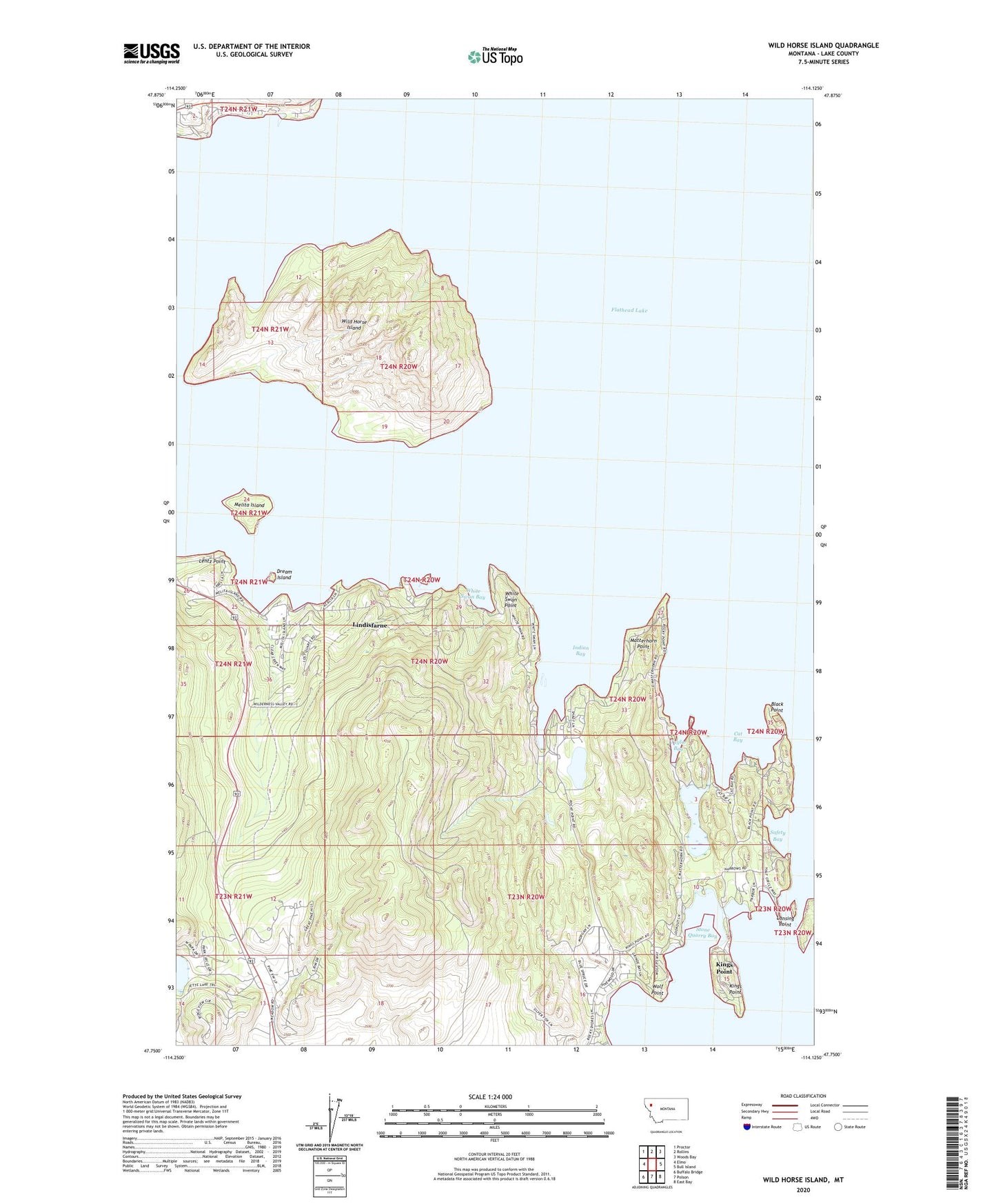
2024 topographic map quadrangle Wild Horse Island in the state of Montana. Scale: 1:24000. Based on the newly updated USGS 7.5' US Topo map series, this map is in the following counties: Lake. The map contains contour data, water features, and other items you are used to seeing on USGS maps, but also has updated roads and other features. This is the next generation of topographic maps. Printed on high-quality waterproof paper with UV fade-resistant inks.
Quads adjacent to this one:
West: Elmo
Northwest: Proctor
North: Rollins
Northeast: Woods Bay
East: Bull Island
Southeast: East Bay
South: Polson
Southwest: Buffalo Bridge
This map covers the same area as the classic USGS quad with code o47114g2.
Contains the following named places: 23N20W04BBA_01 Well, 23N20W10DCDC01 Well, 23N20W16BDCA01 Well, 23N20W16CBC_01 Well, 23N21W13BBD_01 Well, 24N19W22CBAA01 Well, 24N21W25DDD_01 Well, 24N21W36AAA_01 Well, 24N21W36DBCA01 Well, Black Point, Cat Bay, Dream Island, Flathead Lake State Park - Wild Horse Island Unit, Indian Bay, Jette Lake, Kings Point, Kings Point Census Designated Place, Lansing Point, Lentz Point, Lindisfarne, Lindisfarne Census Designated Place, Little Bull, Little Bull Island, Matterhorn Point, Melita Island, Safety Bay, Stone Quarry Bay, Taylor Bay, White Swan Bay, White Swan Point, Wild Horse Island, Wolf Point, Wymore Lake