MyTopo
Rollins Montana US Topo Map
Couldn't load pickup availability
Also explore the Rollins Forest Service Topo of this same quad for updated USFS data
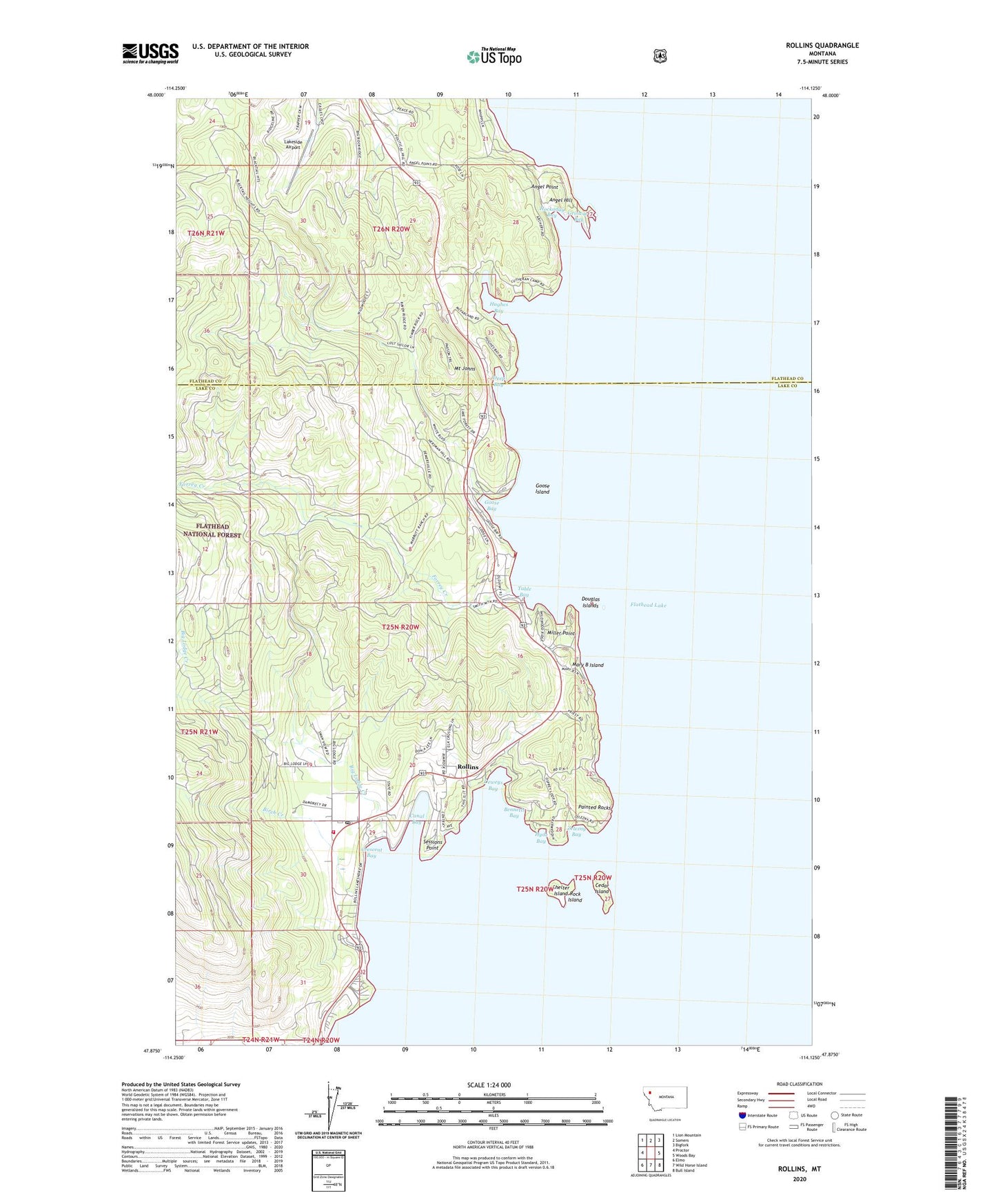
2024 topographic map quadrangle Rollins in the state of Montana. Scale: 1:24000. Based on the newly updated USGS 7.5' US Topo map series, this map is in the following counties: Lake, Flathead. The map contains contour data, water features, and other items you are used to seeing on USGS maps, but also has updated roads and other features. This is the next generation of topographic maps. Printed on high-quality waterproof paper with UV fade-resistant inks.
Quads adjacent to this one:
West: Proctor
Northwest: Lion Mountain
North: Somers
Northeast: Bigfork
East: Woods Bay
Southeast: Bull Island
South: Wild Horse Island
Southwest: Elmo
This map covers the same area as the classic USGS quad with code o47114h2.
Contains the following named places: Angel Hill, Angel Point, Bennetts Bay, Big Lodge Creek, Big Sky RV Resort and Marina, Birch Creek, Canal Bay, Cedar Island, Crescent Bay, Deep Bay, Deweys Bay, Douglas Islands, Flathead Lake, Flathead Lake State Park - West Shore Unit, Forrey Creek, Glacier Campground, Goose Bay, Goose Island, Griswold Bay, Hockaday Bay, Hughes Bay, Hyde Bay, Lakeside Airport, Mary B Island, Miller Point, Mount Johns, Painted Rocks, Rock Island, Rollins, Rollins Census Designated Place, Rollins Post Office, Rollins School, Rollins Volunteer Fire Department, Sessions Point, Shelter Island, Table Bay, United Methodist Camp, West Shore Campground, West Shore Recreation Site, Zelezny Bay, ZIP Codes: 59922, 59931