
MyTopo
Burnt Mountain Montana US Topo Map
Couldn't load pickup availability
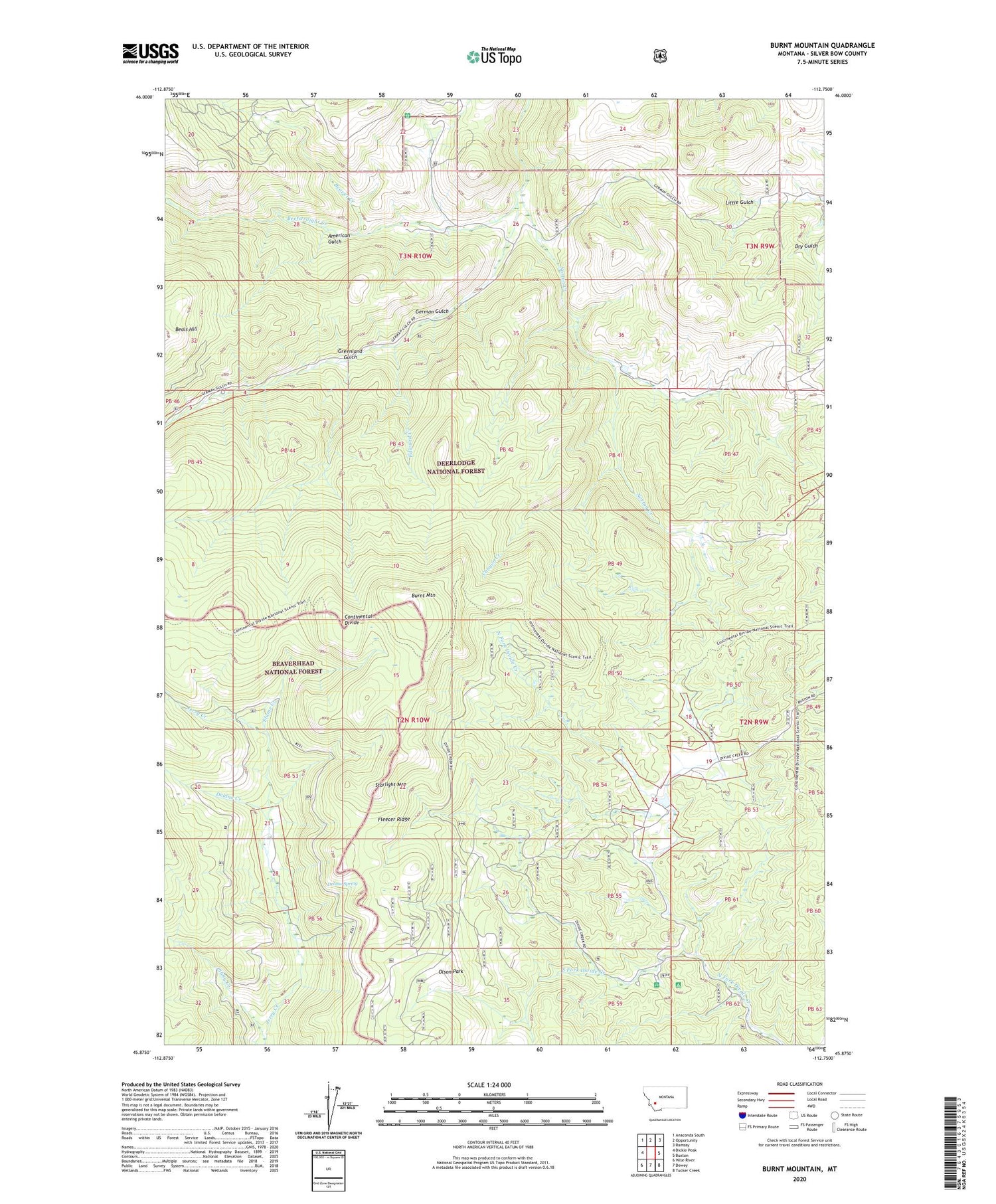
2020 topographic map quadrangle Burnt Mountain in the state of Montana. Scale: 1:24000. Based on the newly updated USGS 7.5' US Topo map series, this map is in the following counties: Silver Bow. The map contains contour data, water features, and other items you are used to seeing on USGS maps, but also has updated roads and other features. This is the next generation of topographic maps. Printed on high-quality waterproof paper with UV fade-resistant inks.
Quads adjacent to this one:
West: Dickie Peak
Northwest: Anaconda South
North: Opportunity
Northeast: Ramsay
East: Buxton
Southeast: Tucker Creek
South: Dewey
Southwest: Wise River
Contains the following named places: Ajax Cabin, American Gulch, Beaver Creek, Beaver Dam Campground, Beefstraight Creek, Bull Ranch, Burnt Mountain, Canyon Creek, Continental Spring, Delano Creek, Delano Place, Delano Spring, Edward Creek, Flume Creek, German Gulch, German Gulch Placer Mine, German Gulch Post Office, Greenland Gulch, High Rye Cabin, Indian Queen Mine, Libby Creek, Norton Creek, Olson Park, Sciuchetti Place, South Fork Divide Creek, Starlight Mountain, ZIP Code: 59750


