MyTopo
Bynum Montana US Topo Map
Couldn't load pickup availability
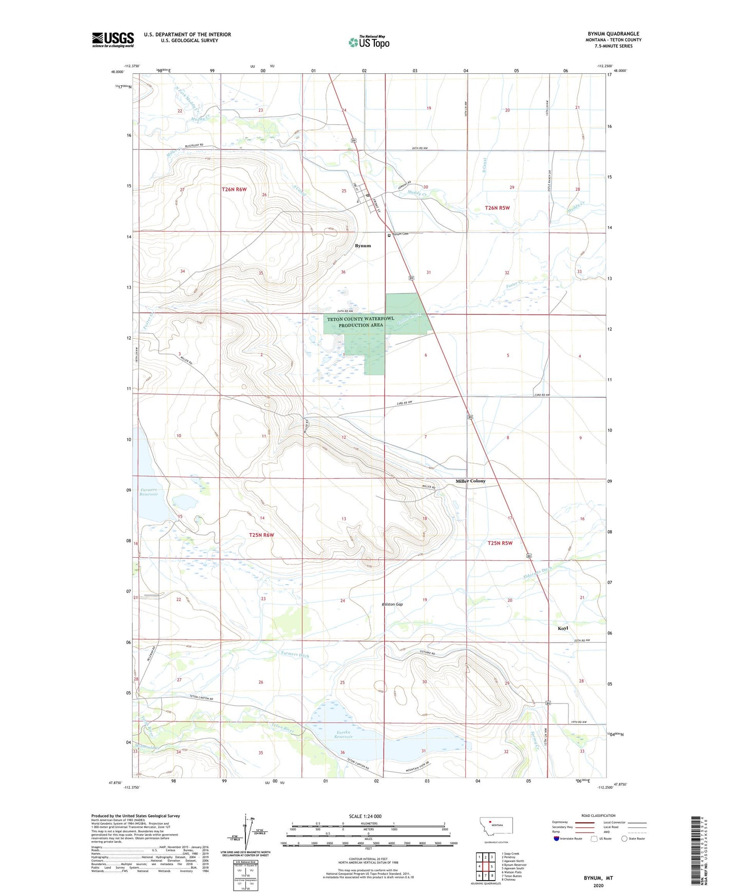
2020 topographic map quadrangle Bynum in the state of Montana. Scale: 1:24000. Based on the newly updated USGS 7.5' US Topo map series, this map is in the following counties: Teton. The map contains contour data, water features, and other items you are used to seeing on USGS maps, but also has updated roads and other features. This is the next generation of topographic maps. Printed on high-quality waterproof paper with UV fade-resistant inks.
Quads adjacent to this one:
West: Bynum Reservoir
Northwest: Soap Creek
North: Pendroy
Northeast: Agawam North
East: Agawam South
Southeast: Choteau
South: Teton Buttes
Southwest: Watson Flats
Contains the following named places: 25N05W05D___01 Well, 26N05W20____01 Well, 26N05W30____01 Well, Armstrong Ranch, Black Ranch, Blixrud Ranch, Bynum, Bynum Cemetery, Bynum Census Designated Place, Bynum Elementary School, Bynum Post Office, D Canal, Eldorado Ditch, Erickson Ranch, Eureka Reservoir, Eureka Reservoir Dam, Eureka Reservoir Fishing Access Site, Fabrick Ranch, Farmers Coop Canal Company Dam, Farmers Ditch, Farmers Reservoir, Koyl, Koyl Post Office, Larson Ranch, McDonald Creek, Methodist Episcopal Church, Miller Colony, Miller Colony Census Designated Place, Miller Colony School, Miller Creek, Monkman Ranch, North Fork Muddy Creek, Pelzman Ranch, Perkins Ranch, Ralston Gap, Rowland School, S Canal, Saint Patricks Church, The Church of Jesus Christ of Latter Day Saints, Trexler Ranch