
MyTopo
Calico Creek Montana US Topo Map
Couldn't load pickup availability
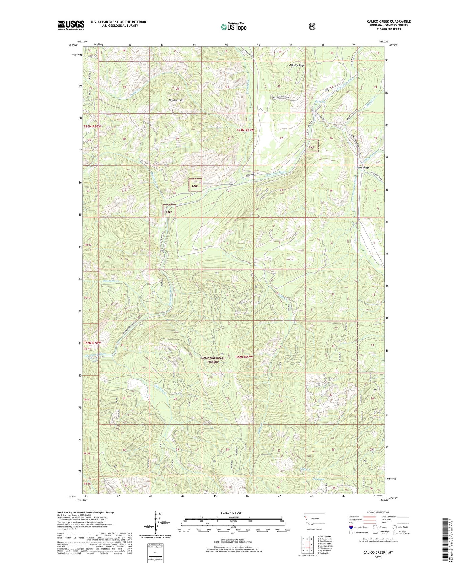
2020 topographic map quadrangle Calico Creek in the state of Montana. Scale: 1:24000. Based on the newly updated USGS 7.5' US Topo map series, this map is in the following counties: Sanders. The map contains contour data, water features, and other items you are used to seeing on USGS maps, but also has updated roads and other features. This is the next generation of topographic maps. Printed on high-quality waterproof paper with UV fade-resistant inks.
Quads adjacent to this one:
West: Priscilla Peak
Northwest: Fishtrap Lake
North: Richards Peak
Northeast: Cook Mountain
East: Loneman Creek
Southeast: Weeksville
South: Big Hole Peak
Southwest: Eddy Mountain
Contains the following named places: Barktable Creek, Big Hole Creek, Big Spring, Calico Creek, Deerhorn Creek, Deerhorn Mountain, Fishtrap Creek, Jungle Creek, Little Rock Creek, Little Thompson River, Marten Creek, Sears Gulch, Stobie Ranch, Todd Spring


