MyTopo
Canyon Ferry SE Montana US Topo Map
Couldn't load pickup availability
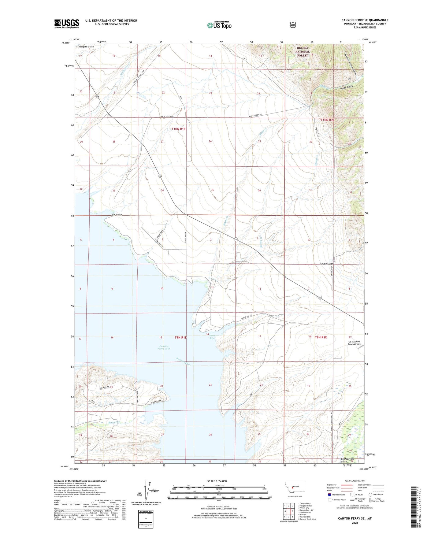
2020 topographic map quadrangle Canyon Ferry SE in the state of Montana. Scale: 1:24000. Based on the newly updated USGS 7.5' US Topo map series, this map is in the following counties: Broadwater. The map contains contour data, water features, and other items you are used to seeing on USGS maps, but also has updated roads and other features. This is the next generation of topographic maps. Printed on high-quality waterproof paper with UV fade-resistant inks.
Quads adjacent to this one:
West: Canyon Ferry SW
Northwest: Canyon Ferry
North: Hellgate Gulch
Northeast: Whites City
East: Diamond City
Southeast: Gurnett Creek West
South: Townsend NE
Southwest: Winston
Contains the following named places: 09N01E22DB__01 Well, 09N01E22DB__02 Well, 09N01E22DC__01 Well, 09N01E25DA__01 Well, 09N01E26DC__01 Well, 09N01E26DC__03 Well, 09N01E27AA__01 Well, 09N01E27AA__02 Well, 09N01E28AAA_01 Well, 09N02E06DD__01 Well, 09N02E19DA__01 Well, 09N02E19DA__02 Well, 09N02E20DB__01 Well, 09N02E29CB__01 Well, 10N01E22CBD_01 Well, 10N01E28AD__01 Well, 10N01E28ADCB01 Well, 10N01E28CABB01 Well, Beaver Creek, Beaver Creek Cemetery, Beaver Creek School, Bilk Gulch, Goose Bay, Goose Bay Marina Campground, Grubb Gulch, Number Sixteen Gulch, Spring Creek, White Creek, White Earth Campground, White Earth Recreation Area, White Gulch