MyTopo
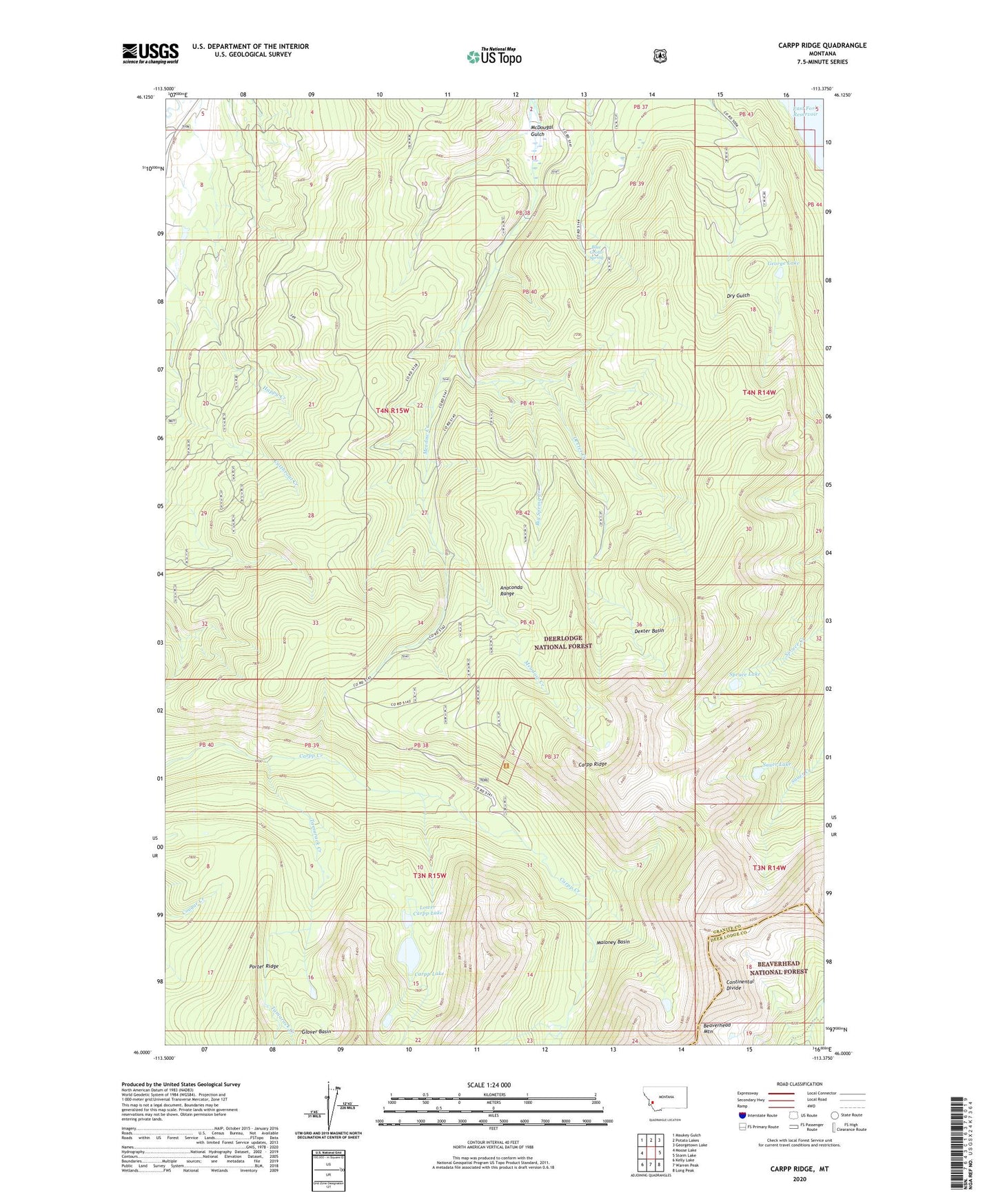
Carpp Ridge Montana US Topo Map
Couldn't load pickup availability
Also explore the Carpp Ridge Forest Service Topo of this same quad for updated USFS data
2024 topographic map quadrangle Carpp Ridge in the state of Montana. Scale: 1:24000. Based on the newly updated USGS 7.5' US Topo map series, this map is in the following counties: Granite, Deer Lodge. The map contains contour data, water features, and other items you are used to seeing on USGS maps, but also has updated roads and other features. This is the next generation of topographic maps. Printed on high-quality waterproof paper with UV fade-resistant inks.
Quads adjacent to this one:
West: Moose Lake
Northwest: Maukey Gulch
North: Potato Lakes
Northeast: Georgetown Lake
East: Storm Lake
Southeast: Long Peak
South: Warren Peak
Southwest: Kelly Lake
This map covers the same area as the classic USGS quad with code o46113a4.
Contains the following named places: Beaverhead Mountain, Big Spring Creek, Blue Grotto Spring, Carpp Lake, Carpp Mine, Carpp Ridge, Dexter Basin, Dexter Creek, George Lake, Lower Carpp Lake, Maloney Basin, McDougal Gulch, Sauer Lake, Spruce Lake, SW SW Section 25 Mine, Tamarack Creek