MyTopo
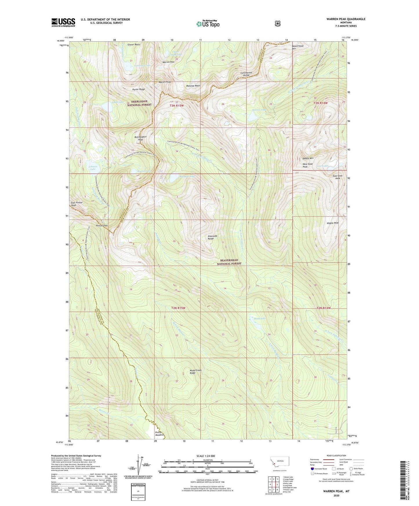
Warren Peak Montana US Topo Map
Couldn't load pickup availability
Also explore the Warren Peak Forest Service Topo of this same quad for updated USFS data
2024 topographic map quadrangle Warren Peak in the state of Montana. Scale: 1:24000. Based on the newly updated USGS 7.5' US Topo map series, this map is in the following counties: Deer Lodge, Granite, Beaverhead. The map contains contour data, water features, and other items you are used to seeing on USGS maps, but also has updated roads and other features. This is the next generation of topographic maps. Printed on high-quality waterproof paper with UV fade-resistant inks.
Quads adjacent to this one:
West: Kelly Lake
Northwest: Moose Lake
North: Carpp Ridge
Northeast: Storm Lake
East: Long Peak
Southeast: Pine Hill
South: Pintler Lake
Southwest: Mussigbrod Lake
This map covers the same area as the classic USGS quad with code o45113h4.
Contains the following named places: Anaconda Pintler Wilderness, Beaver Creek, East Goat Peak, East Pintler Peak, Edith Lake, Glover Basin, Johnson Lake, Last Chance Number Two Mine, Lost Lakes, Martin Lake, McGlaughlin Peak, Mudd Creek Ridge, Mudd Lake, Nipple Peak, Palisade Creek, Pintler Pass, Porter Ridge, Rainbow Lake, Saddle Mountain, SE Section 17 Mine, Tamarack Lake, Upper Carpp Lake, Warren Lake, Warren Pass, Warren Peak, West Goat Peak