MyTopo
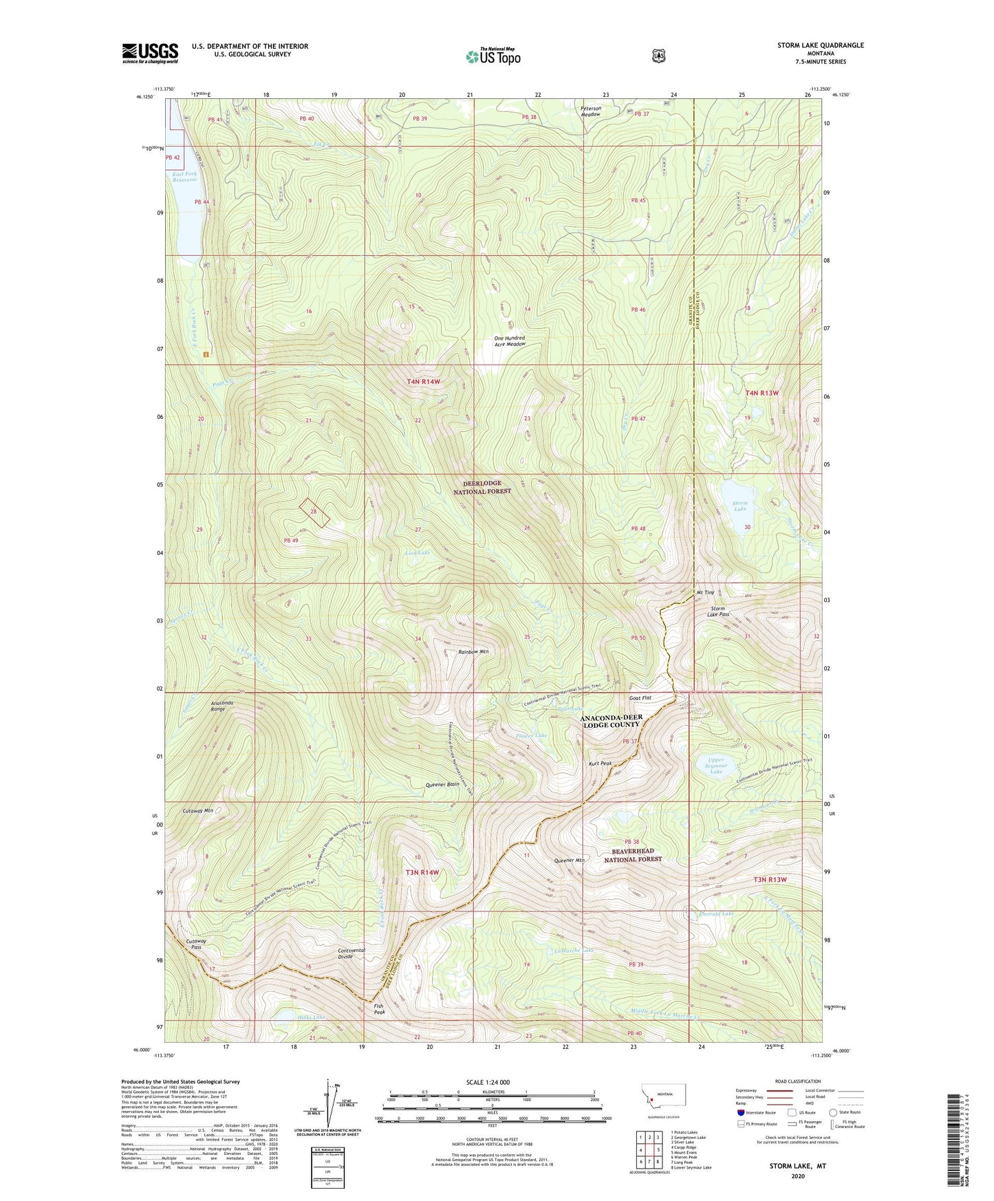
Storm Lake Montana US Topo Map
Couldn't load pickup availability
Also explore the Storm Lake Forest Service Topo of this same quad for updated USFS data
2024 topographic map quadrangle Storm Lake in the state of Montana. Scale: 1:24000. Based on the newly updated USGS 7.5' US Topo map series, this map is in the following counties: Granite, Deer Lodge. The map contains contour data, water features, and other items you are used to seeing on USGS maps, but also has updated roads and other features. This is the next generation of topographic maps. Printed on high-quality waterproof paper with UV fade-resistant inks.
Quads adjacent to this one:
West: Carpp Ridge
Northwest: Potato Lakes
North: Georgetown Lake
Northeast: Silver Lake
East: Mount Evans
Southeast: Lower Seymour Lake
South: Long Peak
Southwest: Warren Peak
This map covers the same area as the classic USGS quad with code o46113a3.
Contains the following named places: Cutaway Mountain, Cutaway Pass, Deerlodge National Forest, East Fork Reservoir, Emerald Lake, Fish Peak, Flower Lake, Goat Flat, Hicks Lake, Kurt Peak, LaMarche Lake, Lion Lake, Minnie Lee Mine, Mount Tiny, NE SE Section 7 Mine, NW NE Section 14 Mine, One Hundred Acre Meadow, Page Creek, Page Lake, Queener Basin, Queener Mountain, Rainbow Mountain, Sauer Creek, SE NE Section 11 Mine, SE NW Section 12 Mine, SE NW Section 14 Mine, SE SW Section 1 Mine, Spruce Creek, Storm Lake, Storm Lake Dam, Storm Lake Pass, Sunshine Mine, T and A Mine, Upper Seymour Lake