MyTopo
Chadborn Montana US Topo Map
Couldn't load pickup availability
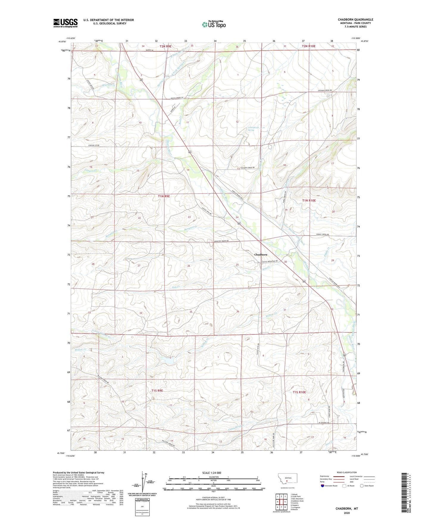
2024 topographic map quadrangle Chadborn in the state of Montana. Scale: 1:24000. Based on the newly updated USGS 7.5' US Topo map series, this map is in the following counties: Park. The map contains contour data, water features, and other items you are used to seeing on USGS maps, but also has updated roads and other features. This is the next generation of topographic maps. Printed on high-quality waterproof paper with UV fade-resistant inks.
Quads adjacent to this one:
West: Gobblers Knob
Northwest: Wilsall
North: Clyde Park
Northeast: Ibex Mountain
East: Grannis
Southeast: Mission
South: Livingston
Southwest: Hoppers
This map covers the same area as the classic USGS quad with code o45110g5.
Contains the following named places: 01N09E02A___01 Well, 01N09E11C___01 Well, 01N09E11C___02 Well, 01N09E12D___01 Spring, 01N09E13C___01 Well, 01N09E14C___01 Well, 01N09E24C___01 Well, 01N09E25D___01 Well, 01N09E36B___01 Well, 01N10E08B___01 Well, 01N10E08B___02 Well, 01N10E19C___01 Well, 01N10E30B___01 Well, 01N10E32D___01 Well, 01S09E01C___01 Well, 01S10E17A___01 Well, 59018, Bangtail Creek, Birch Ranch, Boding Ranch, Bowlds Ranch, Brackett Creek, Brackett Creek Ranch, Bryan Post Office, Canyon Creek, Chadborn, Chadbourn Post Office, Chadbourne Ranch, Chicken Creek, Cowan School, Dunn Ranch, East Fork Spring Creek, Eyman Ranch, Falls Creek, Fiddle Creek, Foster Ranches Airport, Francis Brothers Ranch, Gibson Ranch, Kay Creek, Keys Brothers Ranch, Kirscher Ranch, Lower Shields Valley Ditch, Maroney Ranch, Martin Ranch, North Fork Willow Creek, Queen Ranch, Rock Creek, Sarazim Ranch, Schindler Ranch, Smith Ranch, Spring Creek, Tobin Creek, Tregloan, Tregloan Ranch, Van Gilder Ranch, West Fork Spring Creek, Willow Creek, Wolfe Ranch