MyTopo
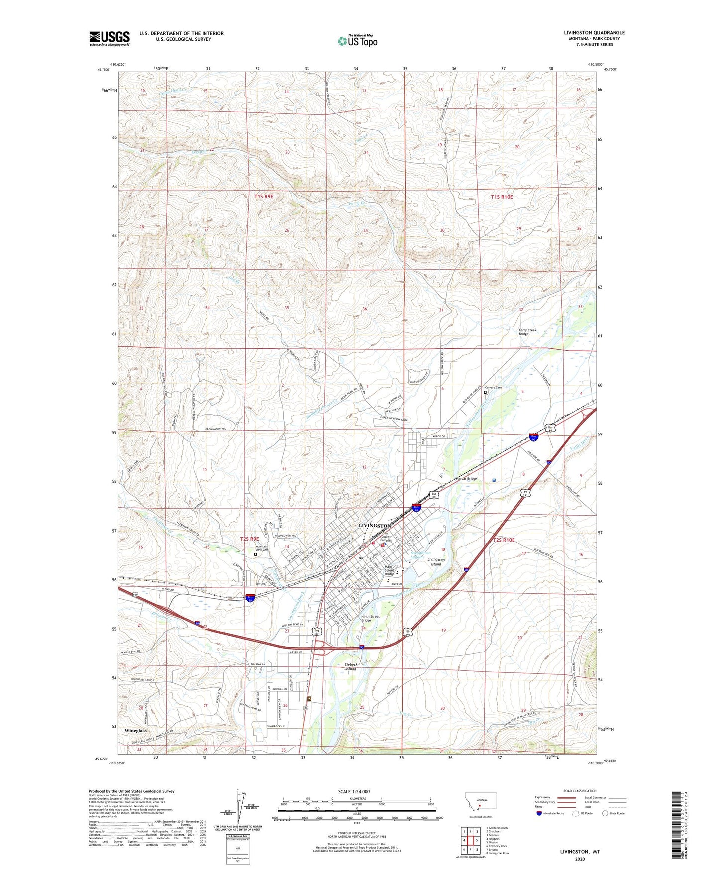
Livingston Montana US Topo Map
Couldn't load pickup availability
Also explore the Livingston Forest Service Topo of this same quad for updated USFS data
2024 topographic map quadrangle Livingston in the state of Montana. Scale: 1:24000. Based on the newly updated USGS 7.5' US Topo map series, this map is in the following counties: Park. The map contains contour data, water features, and other items you are used to seeing on USGS maps, but also has updated roads and other features. This is the next generation of topographic maps. Printed on high-quality waterproof paper with UV fade-resistant inks.
Quads adjacent to this one:
West: Hoppers
Northwest: Gobblers Knob
North: Chadborn
Northeast: Grannis
East: Mission
Southeast: Livingston Peak
South: Brisbin
Southwest: Chimney Rock
This map covers the same area as the classic USGS quad with code o45110f5.
Contains the following named places: 01S10E29A___01 Well, 01S10E32C___01 Well, 02S09E01D___01 Well, 02S09E13A___01 Well, 02S09E13D___01 Well, 02S09E15A___01 Well, 02S09E15A___02 Well, 02S09E23B___01 Well, 02S09E24C___01 Well, 02S09E24D___01 Well, 02S09E26B___01 Well, 02S10E05D___01 Well, 02S10E07B___01 Well, 02S10E07B___02 Well, 02S10E07C___01 Well, 02S10E18B___01 Well, Absaroka Heights Baptist Church, Agrineeds Company Elevator, American Lutheran Church, B A Winans School, Bensons Landing, Bensons Landing Post Office, Billman Creek, Branding Iron Addition, Calvary Cemetery, Cayser Ranch, Church of the Nazarene, City of Livingston, Clark Ranch, Downer, Dry Creek, East Side School, Emmanuel Fellowship Church, Family Chiropractic Center, Ferry Creek, Ferry Creek Bridge, First Baptist Church, Five Acre Tracts/Acreville Addition, Fleshman Creek, Fort Thomas F Meagher, G Street Park, Geyser Trailer Park, Grace United Methodist Church, Green Acres Addition, Harvat Bridge, Heart K Ranch, Heritage Baptist Church, High Ground Addition, Holbrook United Methodist Church, Jack Weimer Memorial Park, Johnson Ranch, Kingdom Hall of Jehovahs Witnesses, KPRK-AM (Livingston), Lincoln School, Livingston, Livingston Assembly of God Church, Livingston Bible Church, Livingston Christian Center, Livingston Church of Christ, Livingston Clinic, Livingston Congregational Church, Livingston Convalescent Center, Livingston Depot Center, Livingston Ditch, Livingston Fire and Rescue, Livingston Golf and Country Club, Livingston Health Care Hospital, Livingston Island, Livingston Memorial Hospital Heliport, Livingston Plaza, Livingston Police Department, Livingston Post Office, Livingston Post Office Annex, Livingston Public Library, Lotts Hospital, Loyd Uhl Ranch, M Street Park, Main Street Bridge, Mars Park, Mayors Landing Fishing Access Site, Meigs Ranch, Merideth Ranch, Miles Park, Minnesota Addition, Mitchell Ranch, Mountain View Cemetery, Mud Lake, Nelson Ranch, New Beginning Church of God, Ninth Street Bridge, Ninth Street Park, North Side School, Osens Campground, Palace Addition, Paradise Livingston Campground, Park Addition, Park Clinic, Park County Chiropractic Center, Park County Courthouse, Park County Fairgrounds, Park County Museum, Park County Rural Fire District 1, Park County Sheriff's Office, Park High School, Park Hospital, Park Place, Park Road Trailer Court, Perry Ranch, Ralph Uhl Ranch, Redeemer Lutheran Church, Riffle Ranch, Riverside Addition, Sacagawea Lagoon, Sacagawea Park, Saint Andrews Episcopal Church, Saint Marys Catholic Church, Saint Mary's Catholic School, Saint Pauls Evangelical Lutheran Church, Seventh Day Adventist Church, Siebeck Island, Slaughterhouse Creek, Sleeping Giant Middle School, Sleeping Giants Wildlife Museum, S-S Motel and Trailer Park, Star Addition, Star Shopping Center, Tandy Ranch, The Church of Jesus Christ of Latter Day Saints, Tie Spur, United Pentecostal Church, Unity Truth Center, Washington Elementary School, Well Child Clinic, Wenth Ranch, Windmill Park, Wineglass Census Designated Place, Yellowstone Crossing Post Office, Yellowstone Gateway Mall


